Skip to content

Cookies 🍪

This site uses cookies that need consent.

Learn more

Zur Powderguide-Startseite Zur Powderguide-Startseite

Language selection

Search PowderGuide

PowderAlerts

PowderAlert 12 2017/18 | Start of the snowfall limit rollercoaster

Up, down, up, down

by Lars Oelmann 12/27/2017
Snorkel necessary - but for snow or rather rain?

Snorkel necessary - but for snow or rather rain?

LH
After a somewhat surprising interim alert in the north, which also brought alarms, we're now off to Ullr Leisure Land and on a wild rollercoaster ride of alarms in the north-west, which will probably last until the end of the first week of January. And as is the way with rollercoasters, we'll all be wavering between cheering and throwing up. When it goes down, we cheer and when the snow line goes up, we feel bad...

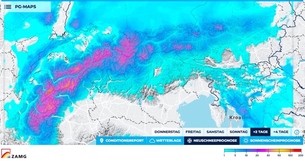
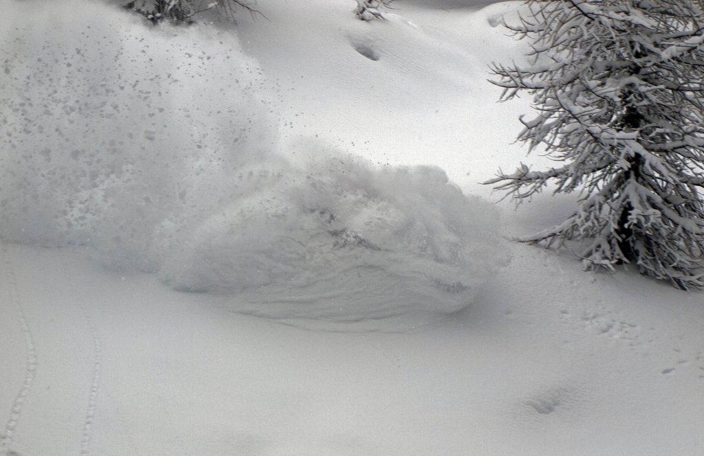
All in all, it will be extremely wet in the near future and the first alarm of the rollercoaster will probably already bring considerable amounts of fresh snow above 2000m. At medium altitudes between 1300 and 1600m, melting and replenishment could balance each other out until the first week of January. Below that, it will probably be less overall.

Alert period and area

Until Saturday in the late evening, and from the Arlberg to the Hautes Alpes. Further east, it will scrape along just at or above the alert limit of 30cm.

Wind

The massive, westerly flow is somewhere between gale force and almost hurricane force. So it will be very, very uncomfortable at the top. Due to the strong current, however, it will push full alarm amounts up to or just over the main ridge in France and deep into Valais.

Snowfall limit

If I could get it right in the Alps, I'd be really good. But I'm not, so there's bound to be something wrong somewhere.

Let's start with the easy stuff in the northwest, the French Prealps and the Northern Alps: It's cold at the moment but the precipitation is coming with a massive warm front and so it will gradually rise unprotected to 2000 or even 2200m in the southwest by the end of Friday night. After all, the greatest warmth will come in dry on New Year's Eve.

This will take longer in Valais, but as it will reach zero degrees over the passes, the Rhone Valley will not be able to hold the cold, so it will rain here too. It could work in the Goms, but it will be really warm - so I'm skeptical.

It will also be a tight squeeze in the Aosta Valley or Pelvoux Massif. Especially as it's so windy. Maybe it will stay snowy above 1400-1600m, but I wouldn't bet on it and then it will be damp and more glop™ than powder in the trees. Here, however, at least a large part will still come as snow before it gets warm.

Snow is only certain in the high Alps and the full amounts only come from 2100-2300m.

The amounts

From the Arlberg to the Bernese Oberland, 40-70cm should come together at the very top, but with the warmth and the wind, there are more surprises at the bottom than at the top. In the core from the northern Valais to the Hautes Alpes, 70-100cm of fresh snow should accumulate high up. This is more likely to be measured high up in the Alps, in the inner Alps and sheltered from the wind, i.e. almost nowhere. It could possibly be 120cm in France, sheltered from the wind in a congested area, but I think it's too warm for that, even if the amount of water is right.

Realistically, 10-200cm of snow will accumulate up there...

Where should I go?

Saturday morning very early up in the inner alpine trees in Valais or Valle d'Aosta and then wait for the rain, which will come by midday at the latest. Tomorrow, Friday, nothing will happen apart from the onset of bad weather. On Sunday, New Year's Eve, it will be early summer and you can plan a north-facing, very flat glacier tour, as everything from 25° onwards will probably unload with the warming.

Fresh snow forecast for the next 2 days

New snow forecast for the next 2 days

PG Wetterservice

Medium term

Cooler again after New Year, then snow again, and then warmer again, and so on. Always quite damp and always very windy and always from the west. It looks like we have the biggest heat peak behind us with New Year's Eve, but with such an uncertain outlook I wouldn't bet on it. In any case, below 1500m there will often be rain. Maybe the oracle will be on its way, maybe that will help a bit and Ullr will drop the temperature by 1-2°C. In any case, there will be no shortage of precipitation.

Glop™ to the people!

Your oracle

As always, the link to the prediction game follows as a comment under the alert.

This article has been automatically translated by DeepL with subsequent editing. If you notice any spelling or grammatical errors or if the translation has lost its meaning, please write an e-mail to the editors.

Show original (German)

Related articles

Comments