Variation
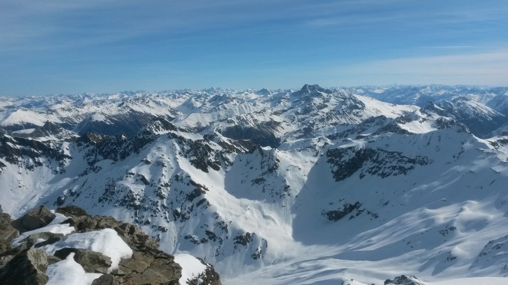
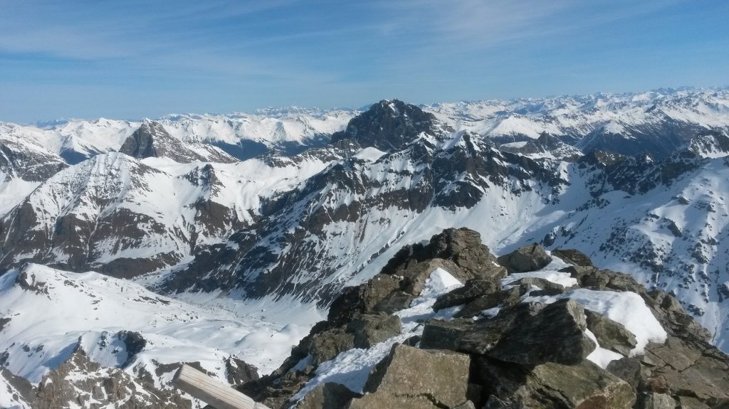
Depending on snow conditions, fitness level and weather conditions, there are several variants on this tour. The most obvious option is to climb over the steep slope on the ascent to Piz d'Err on the western side and reach the left side of Piz d'Err. Just like on the right side, there is also a glacier there. And just like on the other side, the slope at the end of the glacier leads steeply into the valley basin to Alp d'Err.
Conclusion
It takes a little planning to complete the tour as a one-day project. As you don't return directly to the starting point, it's worth considering where you want to leave the car. Or whether it is better to do the tour by public transport. As always, this depends on various factors.
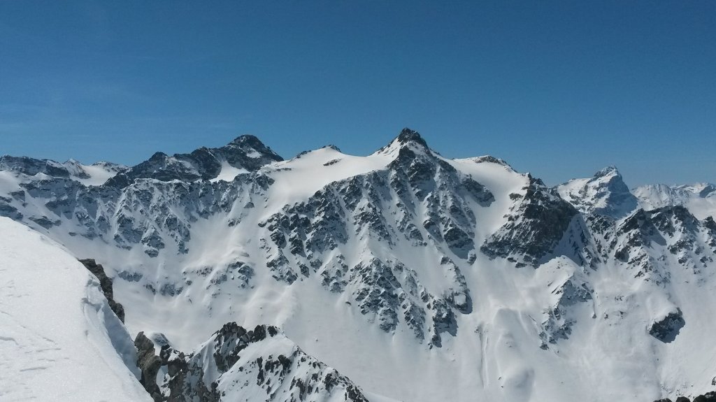
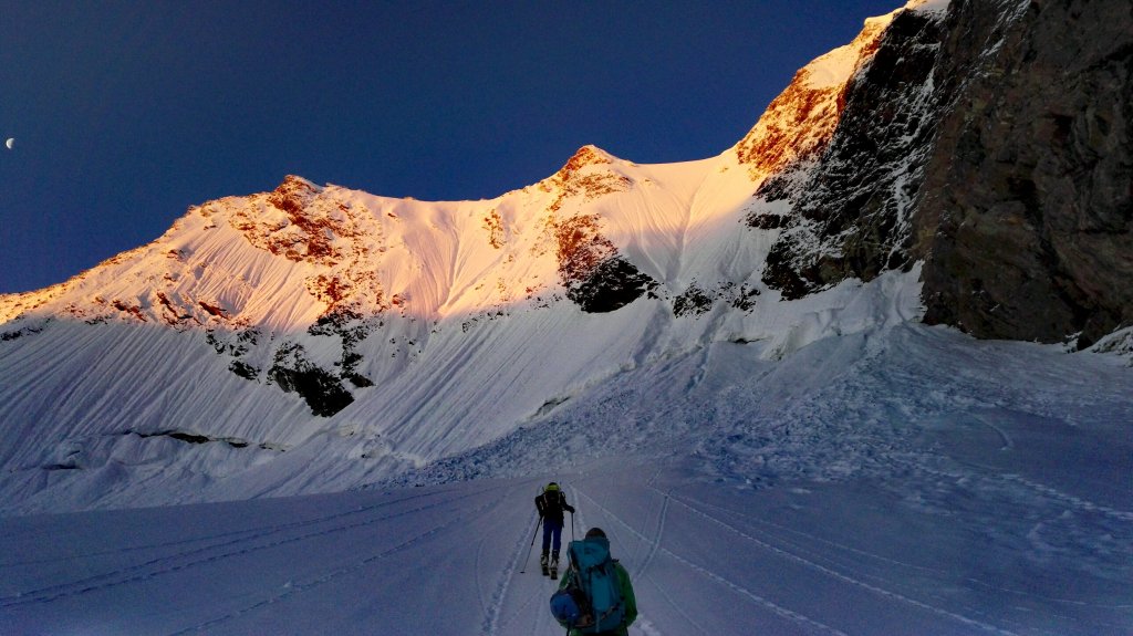
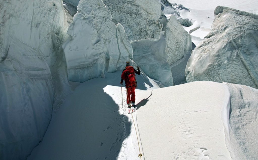
The ascent is particularly challenging on the steep southern slope. Crampons skis and probably also for feet can make things easier. The descent is world-class, but requires safe conditions as the slope is very steep and difficult to see.
The further descent through the valley is no longer difficult. Nevertheless, the valley, which is only open in summer, has its charm. The forest road through the forest should not be underestimated either, as it is not particularly wide and the terrain around it is steep in some areas. In certain snow conditions, it's not easy to ski down there in style.
At the end of the day, the Pir D'Err is an extremely rewarding but challenging tour in an area where you don't meet very many ski tourers.
Information
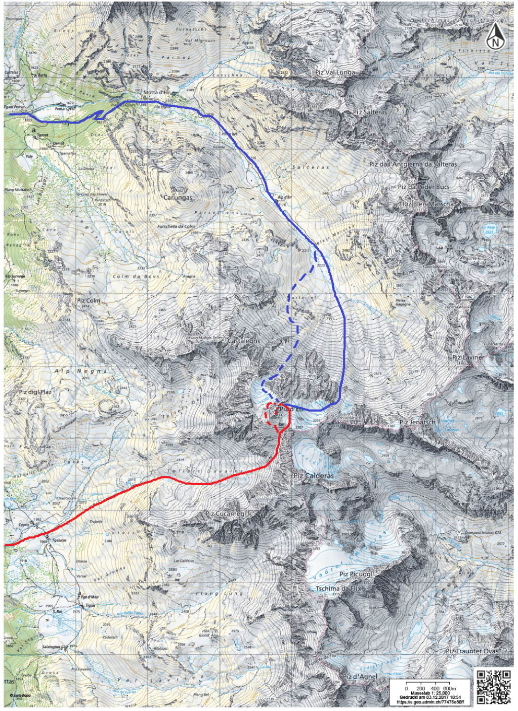
To get from Tinizong to Sur, it's best to briefly check the bus connections over the Julier Pass at www.sbb.ch. We parked our car at the end of the passable section of the road from Sur towards Alp Flix. Information on snow conditions is difficult to find. Generally speaking, the area in Central Grisons is not blessed with record amounts of snow, which can significantly influence the conditions for safe conditions and sufficient snow, especially in the lower altitudes. The webcams in Bivio and Savognin may provide useful information.
Important! Northeast of the stream in the valley to Alp d'Err is a nature protection area. However, there are also some permitted ascents and descents there. It is best to consult the current maps at map.geo.admin.ch.
Difficulty (5-level scale):****
Special dangers: As always, pay attention to the avalanche situation. The descent leads through very steep terrain. Safe walking on steep terrain is also required for the ascent.
Exposure: Ascent mostly south, descent mostly north
Altitude difference start and finish: Start Sur 1610 m, Piz d'Err 3377 m, Tinizong 1232 m
Altitude difference ascent and descent: Attitude difference ascent approx. 1800 vertical meters, descent approx. 2000 vertical meters, depending on snow conditions
Duration: 8 hours
Best time of year: March-April
How to get there: From Tiefencastel, follow the sign in the direction of Alp Flix in the hamlet of Sur. Depending on the snow conditions, park your car in the village or along the road towards Alp Flix.
Note: The PG touring tips are general descriptions of tours that we like subjectively. Our touring tips DO NOT REFER TO CURRENT CONDITIONS. Read the situation report and the weather forecast and plan your tour accordingly.