Skip to content

Cookies 🍪

This site uses cookies that need consent.

Learn more

Zur Powderguide-Startseite Zur Powderguide-Startseite

Language selection

Search PowderGuide

WeatherBlogs

WeatherBlog 11 2017/18 | The calm after the storm

Review, outlook, snow break

by Lea Hartl 01/23/2018
Short dry spell on Monday in Tyrol

Short dry phase on Monday in Tyrol

LH
Stefanie Gruber
Over the last few days, the much overused term "snow chaos" has been quite appropriate in large parts of the Alps. Now the snow-related state of emergency is easing and the cut-off valleys and villages are getting a weather window to dig themselves out in the sunshine.

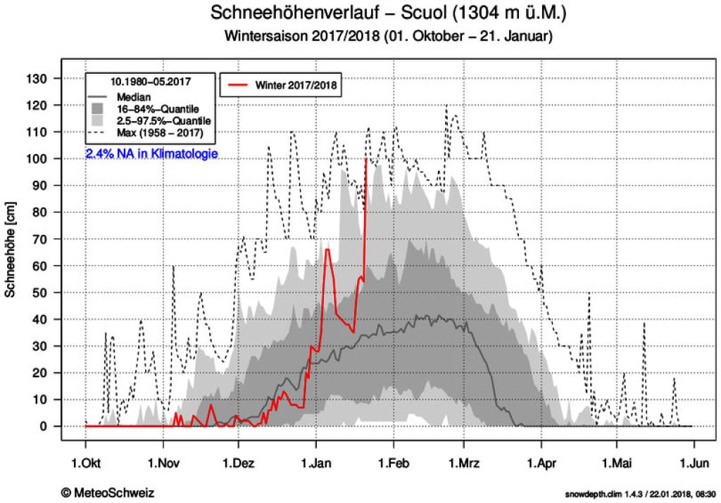
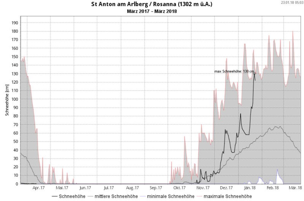
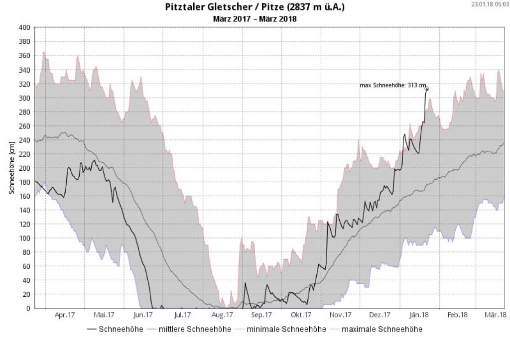
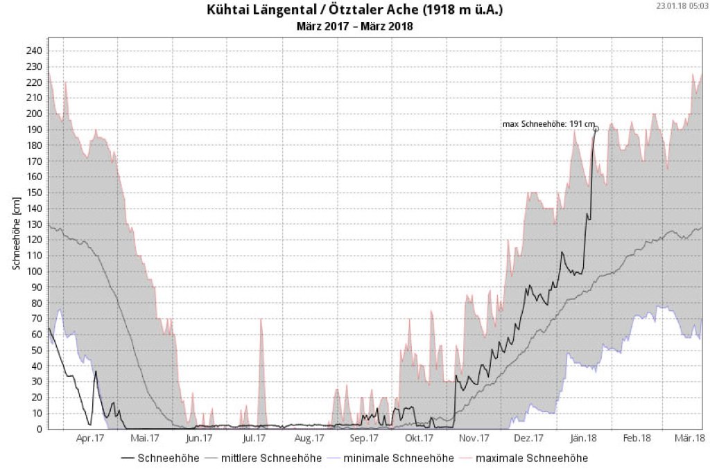
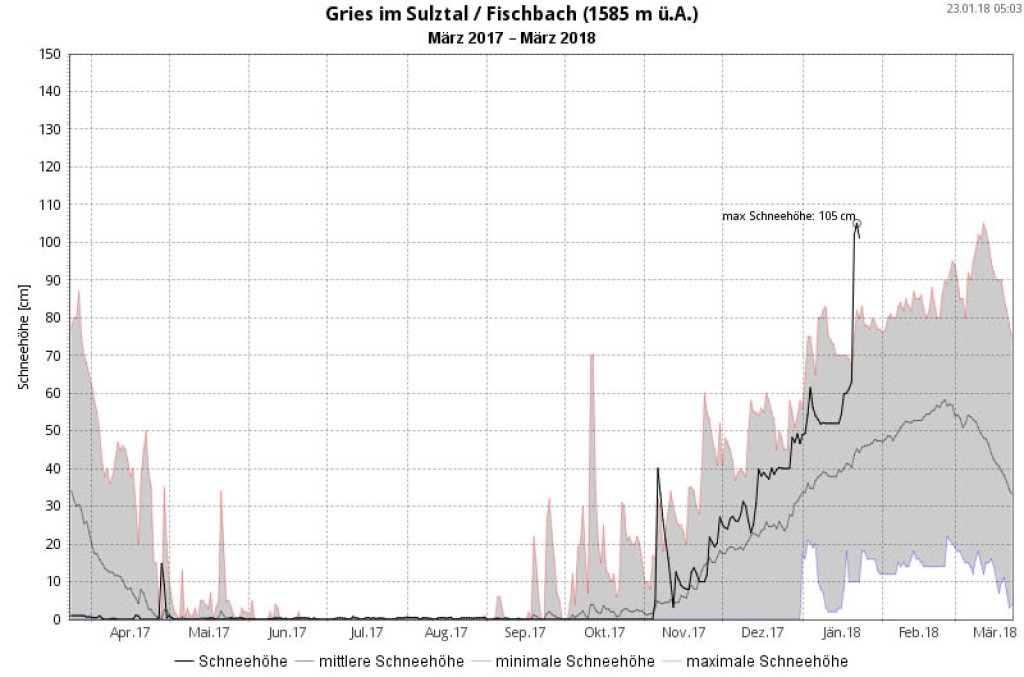
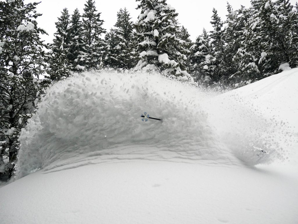
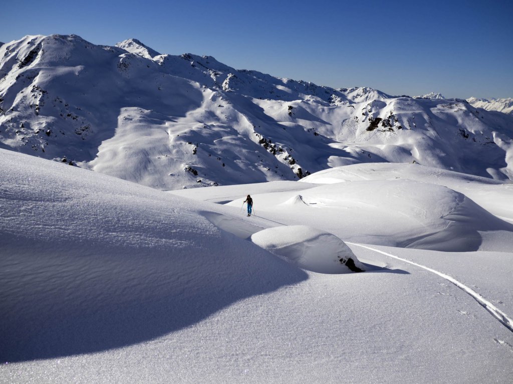
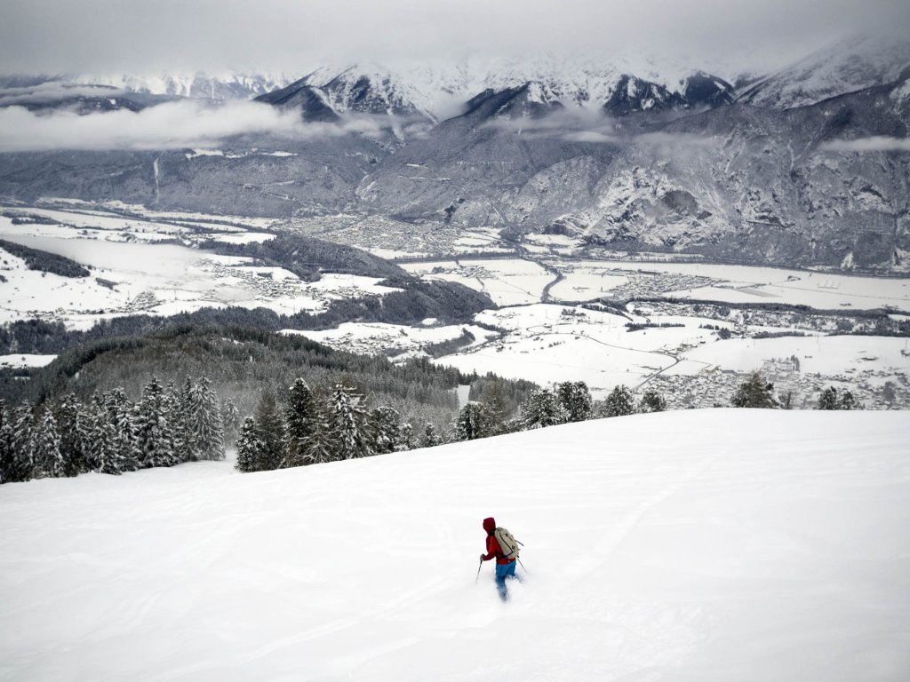
The heavy snowfalls of the last few days

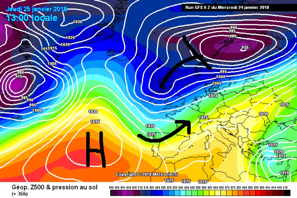
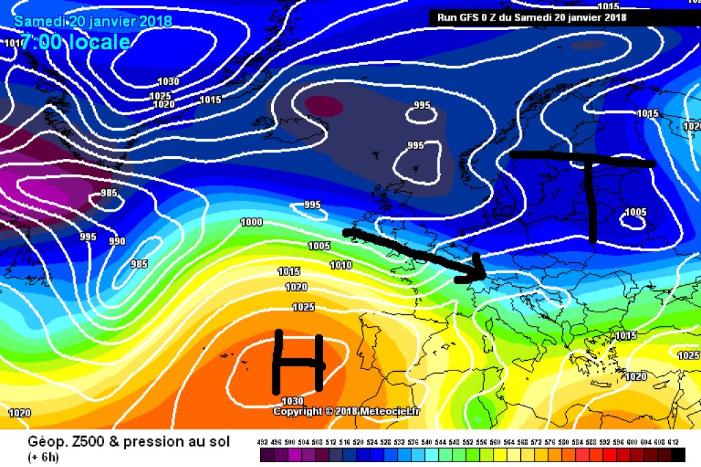
Smaller peripheral lows were steered towards the Alps last weekend and on Monday on the back of a long-wave trough with a main center over the Baltic States. The disturbances were embedded in a very strong north-westerly to westerly current and brought both precipitation and strong storms. Various fronts reached the Alps in several stages, with the snow line briefly rising to around 2000m, especially in the west, with the arrival of a strong warm front on Monday.

In view of the fresh snow totals of 1 to 2 meters in two days and the significant rise in temperature, a level 5 was issued in large parts of Switzerland on Monday, as well as in the west of Tyrol. A number of villages and valleys, including the many tourists currently living there, are affected by road closures and snowed in, including St. Anton, the Paznaun Valley, Andermatt, Zermatt and Livigno. In addition to many smaller roads, the Reschen Pass, the Fern Pass and the German-Austrian border crossing at Scharnitz were also temporarily closed due to the risk of avalanches. Mudslides also became an acute problem due to the heavy rain: a mudslide caused a closure of the Gotthard highway on Tuesday. A mudslide also hit a road and railroad tracks in Simmental. There were considerable disruptions to train and road traffic, even on routes that were not closed. Some roads were already reopened yesterday, and some of the remaining closures are likely to be lifted in the course of today.

WeatherBlogs
presented by

Classification in the snowfall statistics

The SLF last issued a similarly large-scale five in February 1999 and, in view of this, made an interesting comparison between the most recent snowfall period and the snowfalls of February 1999, which led to the catastrophic avalanche in Galtür, among other things. At that time, level 5 applied in Switzerland for 5 days, from February 21 to 25, this time from Sunday evening to Tuesday morning, i.e. 1.5 days.

The new snowfall totals for the most intensive precipitation phases of 1999 were 2.5-3.5 meters in 9 days, which corresponded to a 75-100 year event at the corresponding stations. At the stations that had the most snow this time, there was also between 2 and 3 meters of fresh snow in 7 days. This occurs every 15 to 30 years and is therefore a less extreme statistical outlier than in 1999. There was also significantly more snow in 1999 before the heavy snowfall, especially at low altitudes, where a considerable proportion of the precipitation fell as rain in the current winter.

The snow depth maximums of February 1999 have largely not been reached in Switzerland, with the exception of southern Valais, where, according to the SLF, there is as much snow as in February 1999. With regard to snow depths, it is noticeable that it is mainly inner-Alpine measuring stations that are scratching long-term records. For example, in Scuol in the Lower Engadine, an enormous increase in snow depth has been recorded in the last two weeks, which is probably primarily due to the strong high-altitude current, which has pushed the precipitation far into inner-Alpine areas.

In Tyrol, the station data shows a similar picture: it has snowed a lot on the Arlberg. The ZAMG reports: "The sum of all new snowfall in Langen am Arlberg, for example, is currently around 480 centimetres, while the multi-year average for the entire meteorological winter here is 447 centimetres. In Warth am Arlberg, the total amount of fresh snow is currently around 430 centimetres, compared to an average of 370 centimetres for the entire winter. At some inner-Alpine stations, such as in Pitztal or Gries in Sulztal, new maximums have been set for the (not always equally long!) measurement time series.

Snow depth measurement Scuol

Snow depth measurement Scuol

Meteo Schweiz

Outlook

The weather calmed down considerably yesterday (Tuesday) and today (Wednesday) will be sunny and comparatively warm across the Alps. On Thursday, a trough will approach from the west and the Alps will be affected by a south to south-westerly current on its front. Accumulated precipitation will gradually set in on the southern slopes of the Alps, while it will be foehn in the north. The südstau will bring heavy precipitation in places, especially in the western half of the Alpine arc. We'll leave the details to the oracle. The snowfall will also spread to the northern Alps on Friday, but there will be much less here and a snowy repeat of the last few days is not expected. Saturday still looks rather unsettled from today's perspective, but Sunday will probably be sunny across the board, as is the trend for the first few days of next week.

Photo gallery

This article has been automatically translated by DeepL with subsequent editing. If you notice any spelling or grammatical errors or if the translation has lost its meaning, please write an e-mail to the editors.

Show original (German)

Related articles

Comments

WeatherBlogs
presented by