Skip to content

Cookies 🍪

This site uses cookies that need consent.

Learn more

Zur Powderguide-Startseite Zur Powderguide-Startseite

Language selection

Search PowderGuide

WeatherBlogs

WeatherBlog 15 2017/18 | Winter is not over yet

No one has claimed this, but we'll point it out anyway to be on the safe side.

by Lea Hartl 02/21/2018
LH
While it's just a bit of a flurry in the northern Alps these days, the situation far to the south-east is more exciting, albeit very uncertain. Next week, a phase of extremely wintry temperatures is on the horizon across a large area.

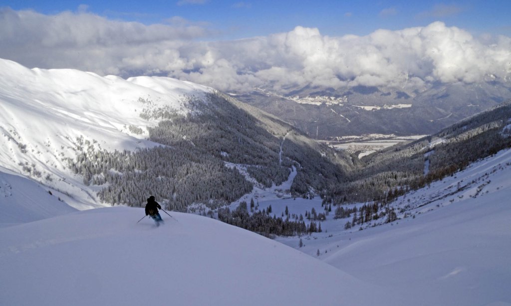
As more-or-less Alpine skiers, the WeatherBlog and PowderAlert have a certain weather bias when it comes to reporting on snow, especially in the "central" Alpine region, which extends roughly from Mont Blanc to the Tauern mountains. Everything to the west, east and south of this axis is already pretty exotic, with Piedmont at most still more or less established as an occasional, "exotic" powder hotspot.

Snow in the south-east?

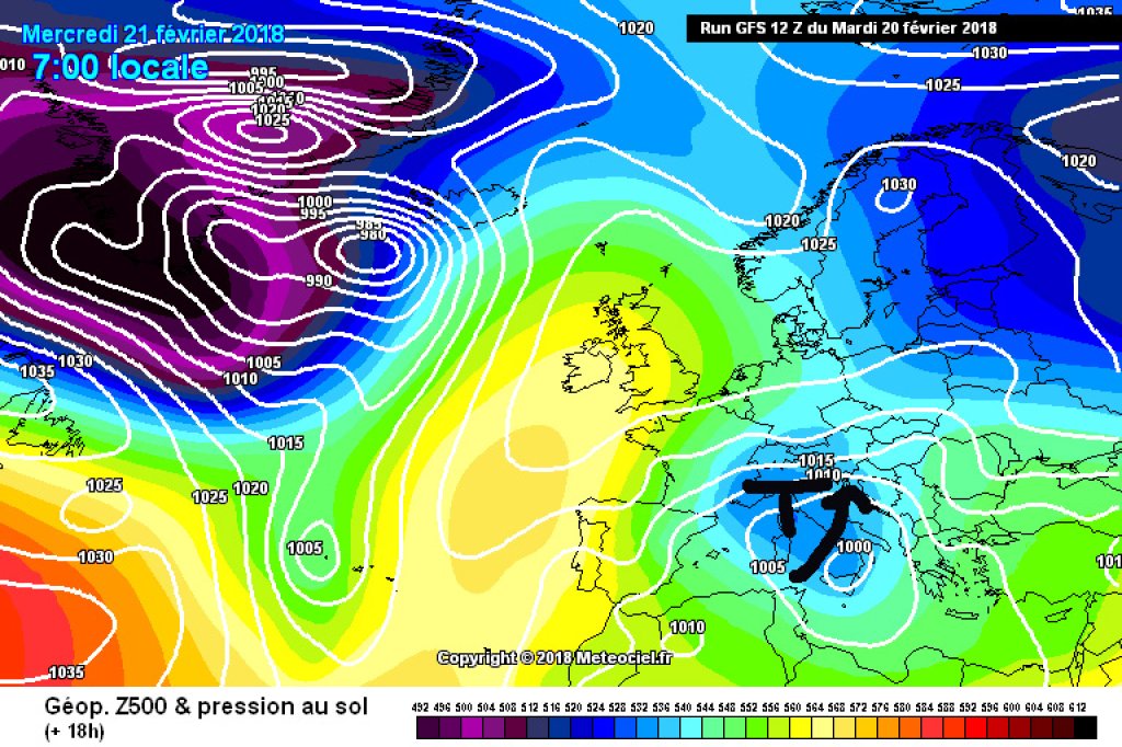
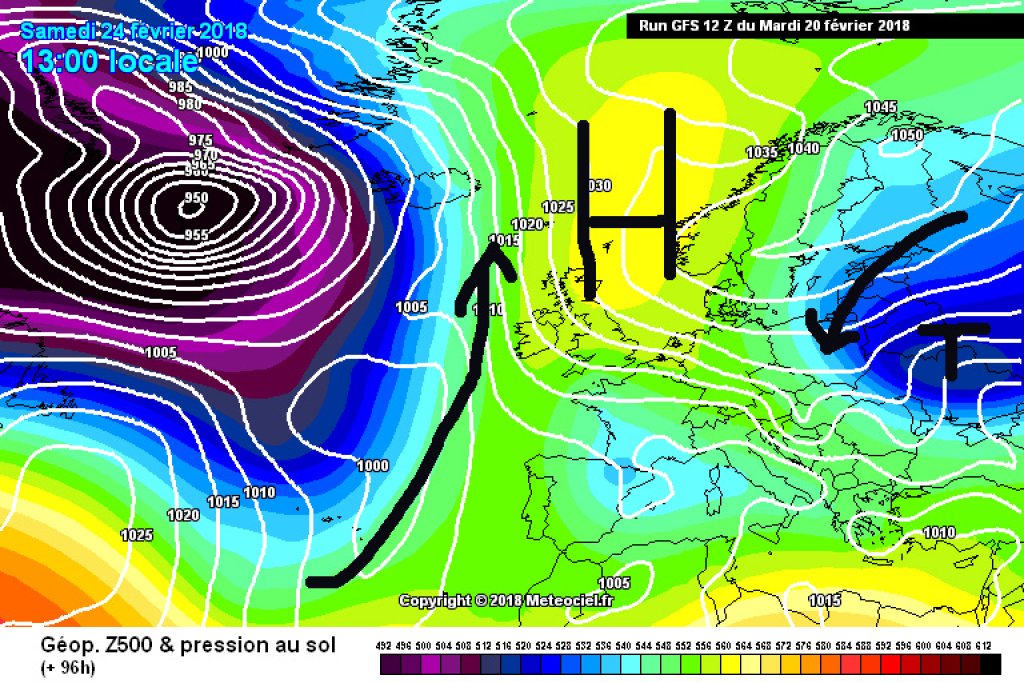
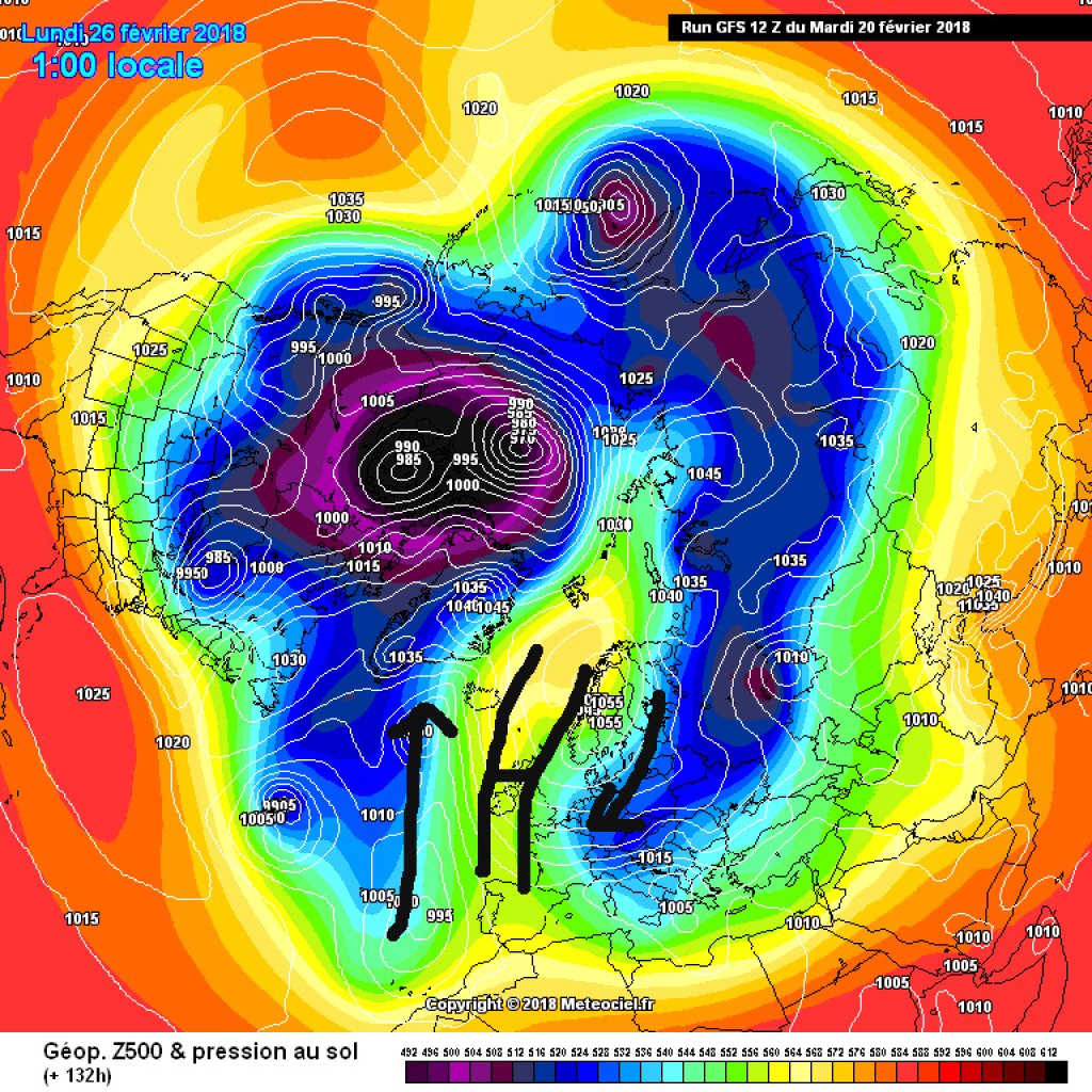
There are still other corners where it snows from time to time and which even have a few mountains. Currently, the development in the far east, from a Tyrolean perspective, is exciting. First and foremost because the weather situation and model runs leave plenty of scope for wintry dreams, which change with every run. As is so often the case with Mediterranean lows, small changes in the track can cause comparatively large changes and so the forecasts are currently fluctuating every few hours between amounts of fresh snow by Friday of nothing to 60cm in Wiener Neustadt, for example (we're guessing: more than nothing but much less than 60cm). Perhaps the Bucklige Welt, also known as the "Land of 1000 Hills", will be the next in-destination for exotic powder? The WeatherBlog is already dreaming of artistic photo stories in ski magazines, with lots of lifestyle and black and white images.

WeatherBlogs
presented by

Further to the south and east, the next few days are set to see a decent amount of fresh snow on a much less shaky footing. It remains to be seen whether this will mainly remain in the Balkans (the real Balkans, not the part of Austria that Tyroleans like to call the Western Balkans) or whether it will move into the PowderGuide oracle's catchment area (the Alps). The best chances are for Slovenia and southern Styria (better known for drinking wine than skiing), although Carinthia has also recently seen some snow in the runs.

Cold thanks to the polar vortex

From a weather point of view, the coming week is at least as interesting, for which the rough timetable is basically already set, surprisingly and in complete contrast to that for the snow over the next few days. The fact that the polar vortex split with a typical blocking situation would make itself felt sooner or later could already be seen last week. The whole thing is now becoming more concrete: A weak high-pressure bridge between Alaska and the British Isles cuts the polar vortex into two parts. Due to the direction of rotation on their eastern flanks, these two low-pressure complexes are causing a massive influx of warm air from subtropical latitudes into the polar regions - on the one hand over Alaska, where it is currently unusually warm, and on the other off the European Atlantic coast and far up into the Arctic Ocean. This in turn blocks the otherwise prevailing westerly drift and the continental cold in the east has a clear path to Central Europe.

500hPa geopotential and ground pressure, Saturday 24.2 Blocking high establishes itself, cold air can flow in from the east.

500hPa geopotential and ground pressure, Saturday 24.2 Blocking high establishes itself, cold air can flow in from the east.

meteociel.fr

It always gets exciting when two air masses with different temperatures meet, for example continental cold air and warm, humid Mediterranean air. If the cold air spreads to the entire Alpine region, the conditions will tend to be dry and cold. If it remains a little further north, depending on the exact position of the air mass boundary, a more changeable borderline weather situation could result in terms of snow. But then, as usual, the serious dreams of the future come to an end and, for the time being, we are left with wishful thinking and at least a fairly certain lowland winter, in the sense of cold even at low altitudes.

Photo gallery

This article has been automatically translated by DeepL with subsequent editing. If you notice any spelling or grammatical errors or if the translation has lost its meaning, please write an e-mail to the editors.

Show original (German)

Related articles

Comments

WeatherBlogs
presented by