Skip to content

Cookies 🍪

This site uses cookies that need consent.

Learn more

Zur Powderguide-Startseite Zur Powderguide-Startseite

Language selection

Search PowderGuide

WeatherBlogs

WeatherBlog 19 2016/17 | Dynamic Atlantic weather provides variety

Still cool and damp in the north.

by Lea Hartl 03/07/2017
Atlantic lows continue to slide from the northwest towards Central Europe and determine the weather in the Alps. After the heavy foehn event at the weekend (wind peaks of 224 km/h on the Lauberhorn, Switzerland) and accumulated precipitation in the south, there will be almost continuous precipitation in the north this week.

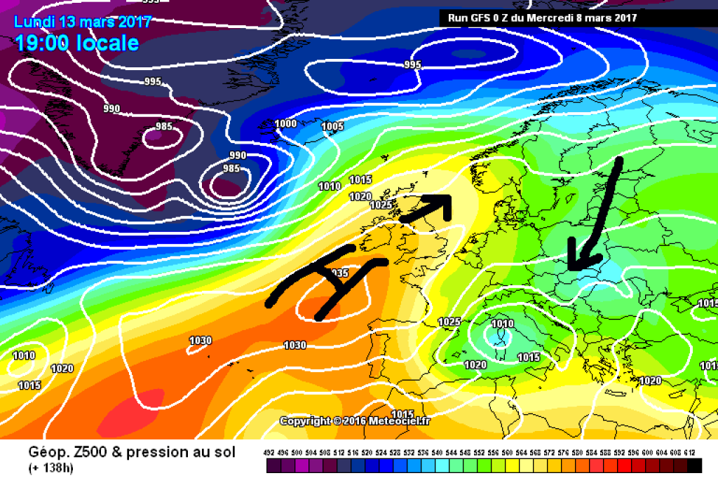
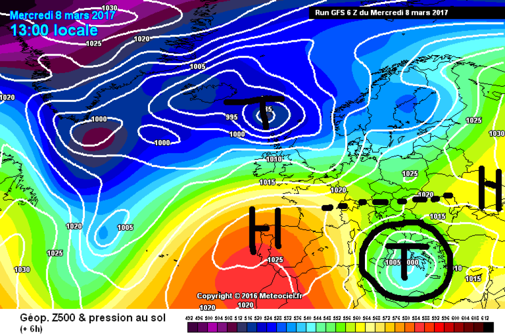
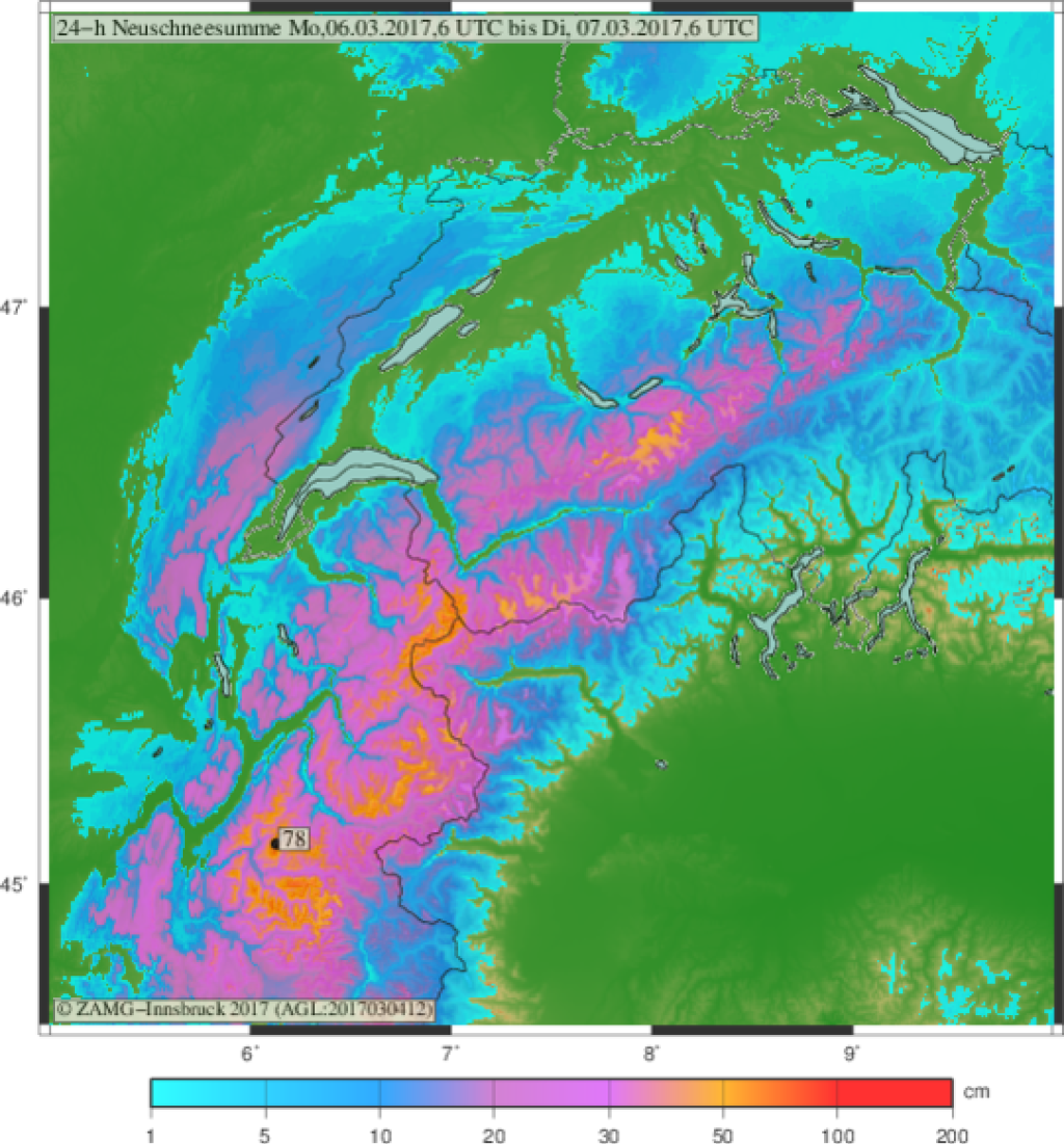
Current situation and outlook

Apart from a brief calmer phase today (Wednesday), the northern Alps in particular have been under the influence of cool Atlantic air and a rapidly changing series of fronts for several days, which are constantly being brought in by new waves of low pressure. Yesterday, the retreating trough of the last alert was still determining the weather character, but today the high pressure pushing in from the west is gaining the upper hand. But only briefly: the next warm front will reach the eastern Alps in the evening (this will happen a little earlier in the west). This will continue more or less until the end of the week. The flow will continue to come from the northwest and Atlantic air with various disturbances embedded in it will reach the northern side of the Alps, although it will be warmer than recently. As usual, more details on fresh snow from the currently very talkative PowderOracle. Thursday will be particularly exciting in terms of the amount of fresh snow in the north, but with a higher snow line than recently (around 1500m). In the south, it will remain clear with hardly any precipitation.

WeatherBlogs
presented by

From the weekend into next week, the weather in the north is currently looking calmer, but still rather cool. The Azores High is curving upwards to the north and moving into a slight oblique position. This allows cold air from the continental east to penetrate towards the Alps, although the weather is still rather high pressure-heavy. We've seen this kind of thing more often this winter. However, the models have already changed their opinion on the development next week several times in the last few days, so it is quite conceivable that things could turn out quite differently - at least theoretically, there is not much missing for a rather wintry situation.

Italian cut-off low

A cut-off low can currently be observed in the Mediterranean region. A cutoff low is an isolated area of low pressure that is not integrated into the large-scale flow. In this case, the small low has drifted southwards away from the larger trough (which recently also affected the Alps). Since yesterday, it has been causing snow (for example in the higher elevations of central Italy, as well as in Greece and Turkey), storms and, above all, quite a lot of thunderstorms for this early time of year.

This article has been automatically translated by DeepL with subsequent editing. If you notice any spelling or grammatical errors or if the translation has lost its meaning, please write an e-mail to the editors.

Show original (German)

Related articles

Comments

WeatherBlogs
presented by