Skip to content

Cookies 🍪

This site uses cookies that need consent.

Learn more

Zur Powderguide-Startseite Zur Powderguide-Startseite

Language selection

Search PowderGuide

WeatherBlogs

WeatherBlog 22 2016/17 | Firn and moisture

Outlook: Sun, less sun at the weekend

by Lea Hartl 03/28/2017
Dwindling snow, but quite good firn where there is still some left.

Dwindling snow, but quite good firn where there is still some left.

LH
LR
This week's WeatherBlog takes its cue from the recent snowFlurry and looks at why humidity is relevant to spring firn. The weather is and remains rather dull, with plenty of sunshine throughout the Alps before it gets a little more unsettled at the weekend.

Current situation and outlook

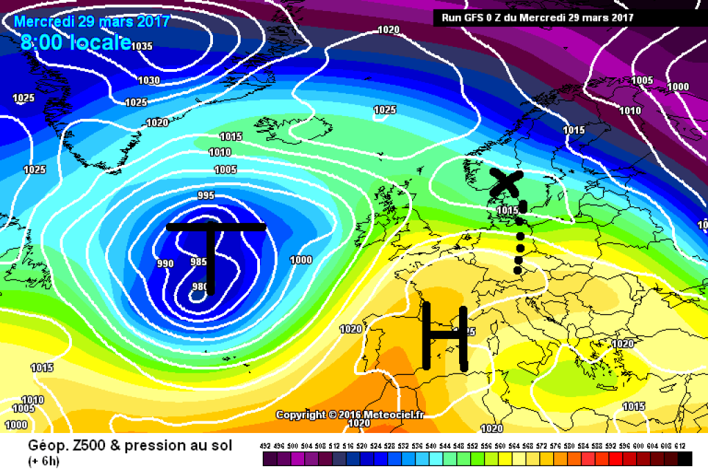
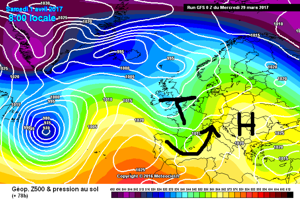
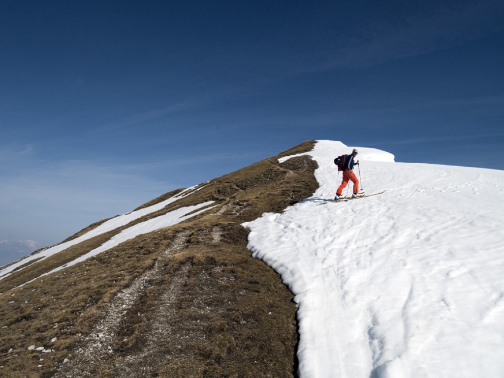
The entire Alpine region is currently under the influence of high pressure. The air mass has been very dry over the last few days, allowing it to cool down considerably at night, while temperatures during the day have reached almost early summer levels in many places. Up to and including Friday, the sunshine in the north and east will be disturbed at most by a few clouds here and there (local showers are possible but unlikely), while in the southwest it will become somewhat more unsettled on Friday: a trough approaching from the west will reach the European Atlantic coast and slide southwards over France. The Alps are at the front of the trough, i.e. to the east of it, and are thus caught in an increasingly southerly flow. It is building up in the south, a Föhn wind is developing in the north and the more humid Mediterranean air is making the weather generally more unstable. What will happen on Sunday is still very uncertain. There are signs of a disturbance from the NW, which will bring cooling and could bring some fresh snow to the higher elevations, especially in the west. What exactly will happen with this disturbance is still quite uncertain, I wouldn't count on it just yet.

Humidity: Basics

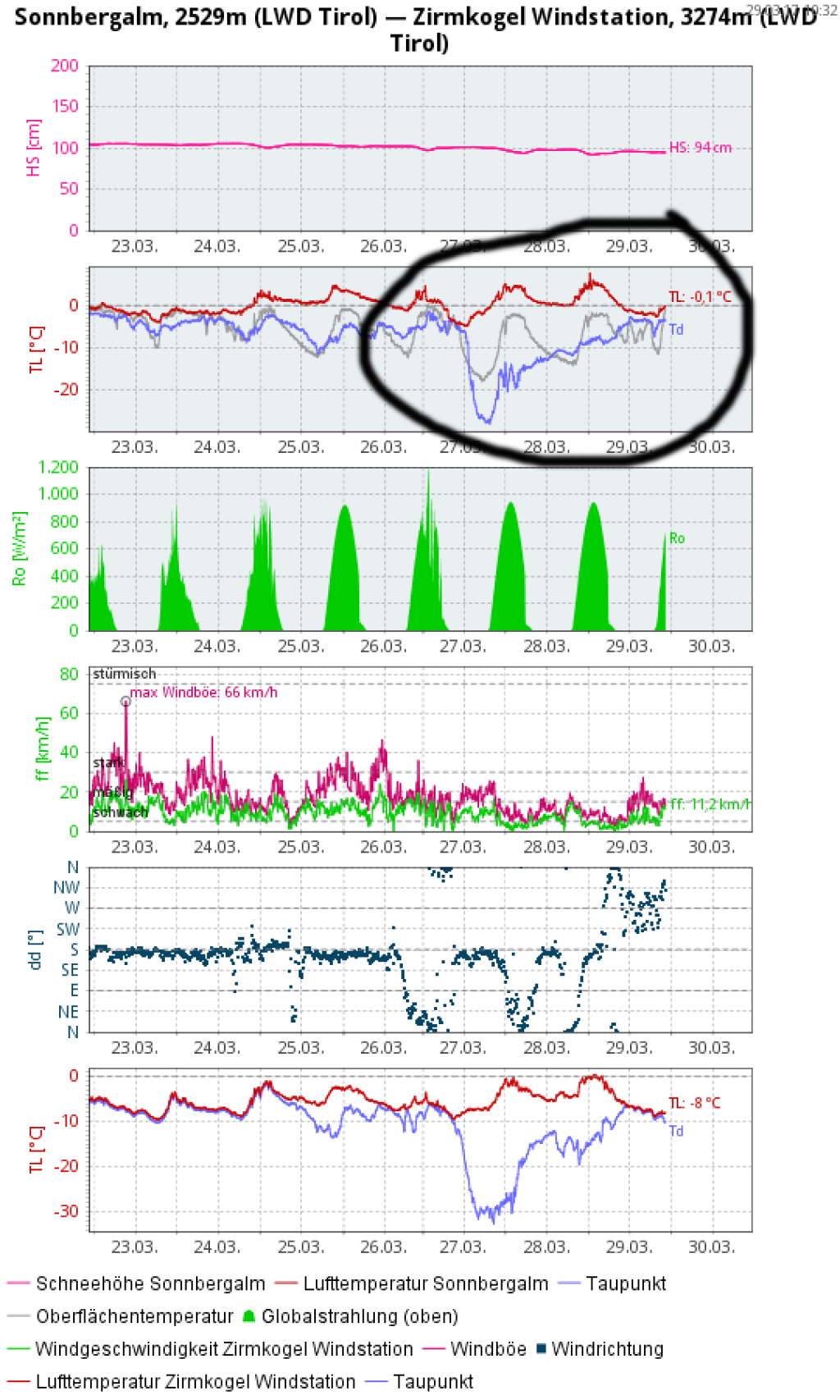
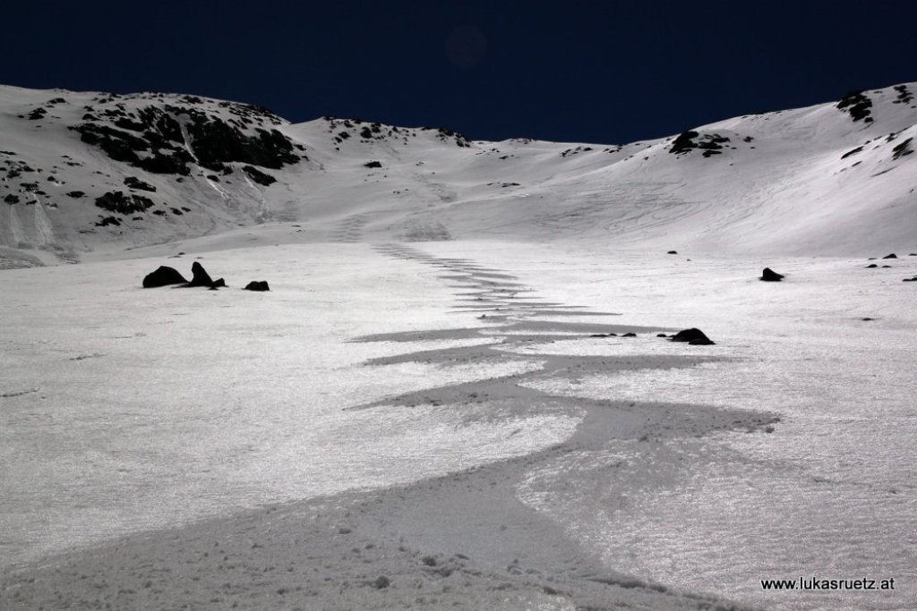
In the last few days, there has been perfect firn in many places due to the very dry conditions. What exactly was humidity again, and why are we interested in it in spring?

Humidity indicates how much water vapor is contained in the air. Absolute humidity is given in "weight of water vapor per volume of air", usually in grams per cubic meter. How much water vapor the air can contain before the water condenses and precipitates as precipitation or dew depends heavily on the temperature, which is why the relative humidity is often given as a percentage rather than the absolute humidity. 100 % corresponds to saturation, i.e. the maximum possible value at a given temperature and air pressure. For a given absolute humidity, the relative humidity is higher at colder temperatures than at warmer temperatures. Cold air can therefore absorb* (footnote!) less moisture than warm air.

WeatherBlogs
presented by

Water vapor and radiation

Water vapor is the most important greenhouse gas in our atmosphere and is responsible for around two thirds of the natural (!) greenhouse effect, without which we would not exist. Water vapor absorbs incoming solar radiation, but also absorbs a large proportion of the thermal radiation (infrared) emitted by the Earth's surface, at least outside the atmospheric window.

The more water vapor there is in the atmosphere, the more thermal radiation can be absorbed, both climatically and globally, as well as on a very small scale when a firn slope cools down at night. If the air is very dry, the nocturnal radiation (heat radiation in the infrared range) can take place unhindered and a beautiful snow cover forms, which turns back into firn during the day. If the air is more humid, the snow surface is less able to radiate and does not cool down as much. The water molecules in the air virtually block the radiation emitted by the snow surface, it does not get away and the surface cools down less.

Dew point difference

To estimate how much the snow surface was able to radiate overnight, the dew point difference is a good measure, which is also often found in weather station data. The dew point is the temperature to which an air parcel would have to be cooled in order to reach saturation. So I have air with a given temperature and a given moisture content below 100%. If I cool the air, the relative humidity rises for the reasons mentioned above. When it reaches 100%, I am at the dew point and the water condenses, for example in the form of dew on the floor, on the window pane or on the tent wall - hence the name. The dew point difference is the difference between the actual temperature and the dew point.

In the station graphic, you can clearly see how the dew point (dew point blue, air temperature red, snow surface temperature gray) drops sharply on March 27 - the air is very dry, so you would have to cool it down a lot to reach saturation or 100% humidity. In the days before, the influence of the low pressure system over the Iberian Peninsula discussed last week was still slightly noticeable. This can be seen in the station graphic by the constant southerly wind direction (slightly foehn-like). This low then finally disappeared from the local weather pattern and the way was cleared for drier, somewhat cooler air from the north (see also rotating wind direction). Today, Wednesday, a very weak disturbance will touch the northern Alps. This only manifests itself in the form of a few clouds and slightly more humid air, which causes the lower dew point difference in the station graph. While the entire Alpine region was almost completely cloud-free yesterday, the effects of the mini disturbance can be seen today in both the visible and IR satellite images.

500hPa geopotential and ground pressure, today, Wednesday 29.3. mini disturbance with a few clouds, impressive high pressure but little.

500hPa geopotential and ground pressure, today, Wednesday 29.3. mini-disturbance grazes with a few clouds, impressing high pressure but little.

meteociel.fr

In the infrared image, you can see the water vapor in the satellite image better than in the visible wavelength range, where you can only see the clouds. Prize question: why?

*The idea that the air "absorbs" water vapor like a sponge is a simplification that doesn't really correspond to the facts. When and how many water particles evaporate or condense has nothing to do with the other components of the air and the saturation concentration is also not a "question of space". If "the air" were a sponge, much more moisture would "fit into it" than is the case at 100% relative humidity. Saturation occurs when evaporation and condensation on a water surface are in balance, i.e. the same number of particles change from the liquid to the gaseous state as vice versa. How much evaporation takes place depends on the kinetic energy of the water particles, not on the rest of the air. Even without the remaining components of the air (nitrogen, oxygen, etc.), almost the same saturation concentration would occur. It's not about how much the air can "absorb", the liquid and gaseous water particles have to sort it out between themselves with the saturation.

Photo gallery

This article has been automatically translated by DeepL with subsequent editing. If you notice any spelling or grammatical errors or if the translation has lost its meaning, please write an e-mail to the editors.

Show original (German)

Related articles

Comments

WeatherBlogs
presented by