Skip to content

Cookies 🍪

This site uses cookies that need consent.

Learn more

Zur Powderguide-Startseite Zur Powderguide-Startseite

Language selection

Search PowderGuide

WeatherBlogs

WeatherBlog 7 2017/18 | Alarm & Outlook

Mild westerly current at the turn of the year

by Lea Hartl 12/26/2017
Green to muddy in the lowlands, white to whitish in the mountains: Christmas 2017.

Green to muddy in the lowlands, white to whitish in the mountains: Christmas 2017.

LH
An Italian low causes strong südstau. This is followed by a cold front in the north and then mild westerly weather. Cold air masses in north-eastern Canada are responsible for the latter, favoring the development of low pressure in the Atlantic.

Current situation and outlook

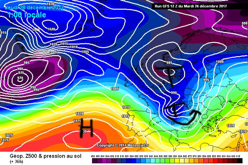
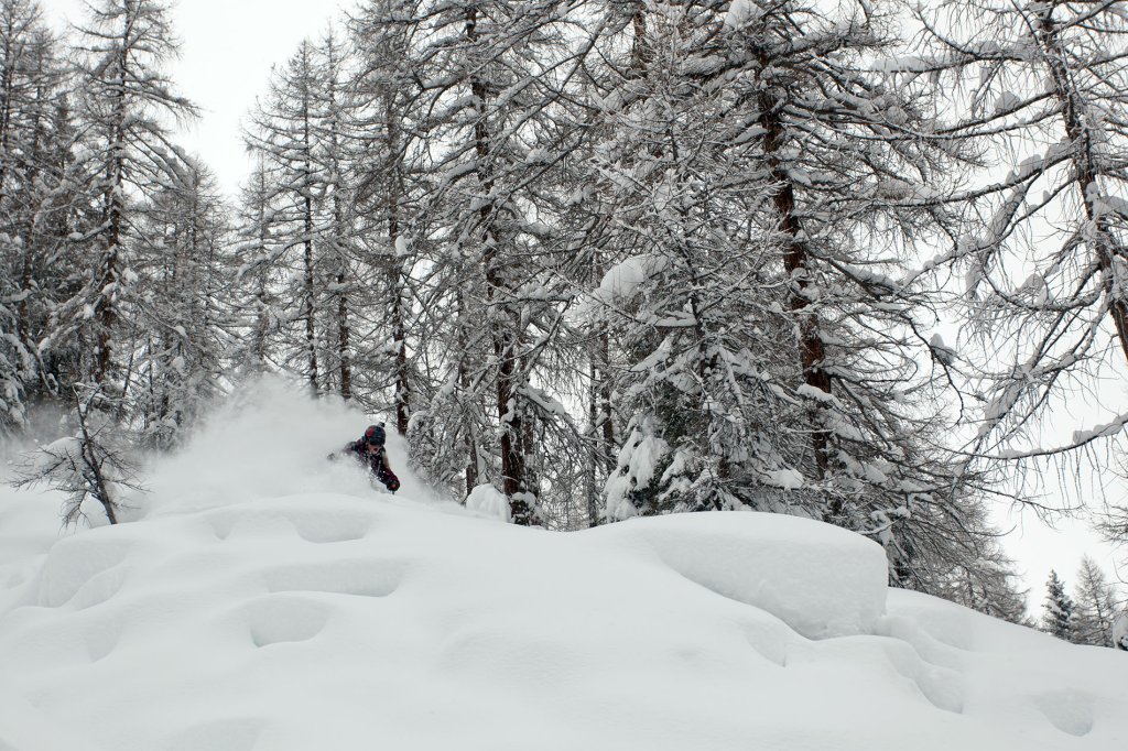
An Italian low is currently dominating the weather in the Alps. Today, Wednesday (27.12.), the low will bring strong foehn winds in the northern Alps and accumulating precipitation in the south. Our colleague Orakel has already commented on the latter in more detail.

The focus of precipitation caused by the Italian low will move more or less along the main Alpine ridge from west to east during the course of the day. The low pressure may tap into a larger trough in the north and its cold air, so it will hopefully stay colder (or at least get colder over the course of the coming night) than during the last südstau.

In the north, the Föhn is likely to break down with the arrival of a cold front during the course of this afternoon. There will then also be precipitation north of the main ridge, including snow in many valleys, at least in the course of Thursday night. The north will probably have to make do with less snow than the südstau hotspots, but at least there will be an interruption to the Christmas thaw here too and the oracle will probably report back again today on the subject of cold fronts.

WeatherBlogs
presented by

On Thursday, the last showers will subside in the north and it will be windy and clear in the south with north föhn winds. On Friday, it will remain cold and sunny pretty much across the board, with only the remnants of cloud probably still hanging around in congested areas.

With the arrival of a warm front on Saturday, the New Year's Eve thaw will continue where the Christmas thaw left off. It will be significantly warmer and at the same time quite stormy and wet. The zero degree line threatens to rise to over 2000m at times. Sunday and Monday will bring calmer but still mild weather before there is a chance of cooling again on Tuesday - at least that is the current opinion of the model globes.

Looking west

If you look beyond the European section of the model maps, the irregular structure of the polar vortex catches the eye. There are very cold air masses in the area of Greenland and the north-eastern corner of the American continent, which cause low temperatures in the east of the USA and Canada on the one hand and low pressure development in the North Atlantic on the other. South of Greenland, new low-pressure complexes will continue to form over the next few days, which will slide towards us in the metaphorical fall line of the westerly drift with classically mild, stormy westerly weather.

This general trend - repeated disturbances, temperature changes, generally mild - could continue for a while if nothing changes in the large-scale structure. This is not conducive to lowland winters. At higher altitudes there is always snow, but also a rather fickle snow line. If the westerly flow gets a stronger southerly component, the situation will become more hostile to winter because it will be warmer; if it turns a little more to the north, things would look better.

500hPa geopotential in the northern hemisphere view, forecast for New Year's Eve. Cold air over the northeast of the American continent will bring Atlantic lows to us on the western track.

500hPa geopotential in the northern hemisphere view, forecast for New Year's Eve. Cold air over the north-east of the American continent will bring Atlantic lows to us on the western track.

meteociel.fr

White and green Christmas

The weather has probably once again been the topic of conversation in many Christmas family gatherings over the last few days. The Christmas thaw was right on time, in many places the thin blanket of lowland snow disappeared on the 23rd and Christmas walks took place on muddy meadows. You can steer the sad conversations about another missed white Christmas in a different direction (commerce! advertising! capitalism from America!) by pointing out that the ideal of a white Christmas only reached us with postcards from the USA, which emigrants sent to those who stayed behind at the end of the 19th century. Before that, there was no snow on European Christmas motifs - outside the high and low mountain ranges, snow is the exception rather than the rule in December. Fortunately, you can head to the mountains if necessary!

Photo gallery

This article has been automatically translated by DeepL with subsequent editing. If you notice any spelling or grammatical errors or if the translation has lost its meaning, please write an e-mail to the editors.

Show original (German)

Related articles

Comments

WeatherBlogs
presented by