Skip to content

Cookies 🍪

This site uses cookies that need consent.

Learn more

Zur Powderguide-Startseite Zur Powderguide-Startseite

Language selection

Search PowderGuide

WeatherBlogs

WeatherBlog 8 2017/18 | Alarm in the Alps, Alarm at the Great Lakes...

The weather makes itself felt

by Lea Hartl 01/02/2018
Lake Effect snow on 31.12.17, satellite image.

Lake Effect snow on 31.12.17, satellite image.

NOAA, MODIS Aqua
Today and tomorrow will be extremely turbulent in the Alps with gale-force winds and heavy precipitation in the west and north. Also changeable at the weekend, with the current turning to the south. Also: spectacular lake-effect snowfall over the holidays in the USA!

Current situation and outlook

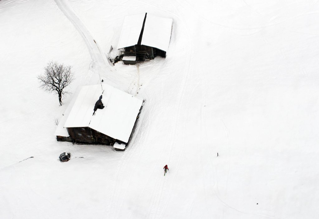
The weather rollercoaster is picking up speed. After the New Year's Eve thaw, today's cold front will bring storms and heavy precipitation to the western and northern Alps. The cold front will be promptly followed tomorrow by a warm front, again with storms and precipitation. The snow line is jumping around wildly, at the moment it's raining up to over 2000m in places, hopefully it will get colder again towards the evening. The weather in the south is less dramatic. Details can be found in the current alert. Due to the combination of a lot of precipitation and a high snow line in some areas, the whole thing is quite critical in terms of flood potential (snowmelt + precipitation). The DWD and ZAMG have also issued severe weather warnings for certain regions (southwest Germany, Tyrol, Vorarlberg) due to heavy precipitation and gale-force winds.

On Friday, things will calm down briefly before the flow turns from north to southwest due to a low pressure system drifting into the Mediterranean and the situation is reversed: calmer, warm and foehn-like weather in the north, sometimes a lot of precipitation in the south with a changeable snow line.

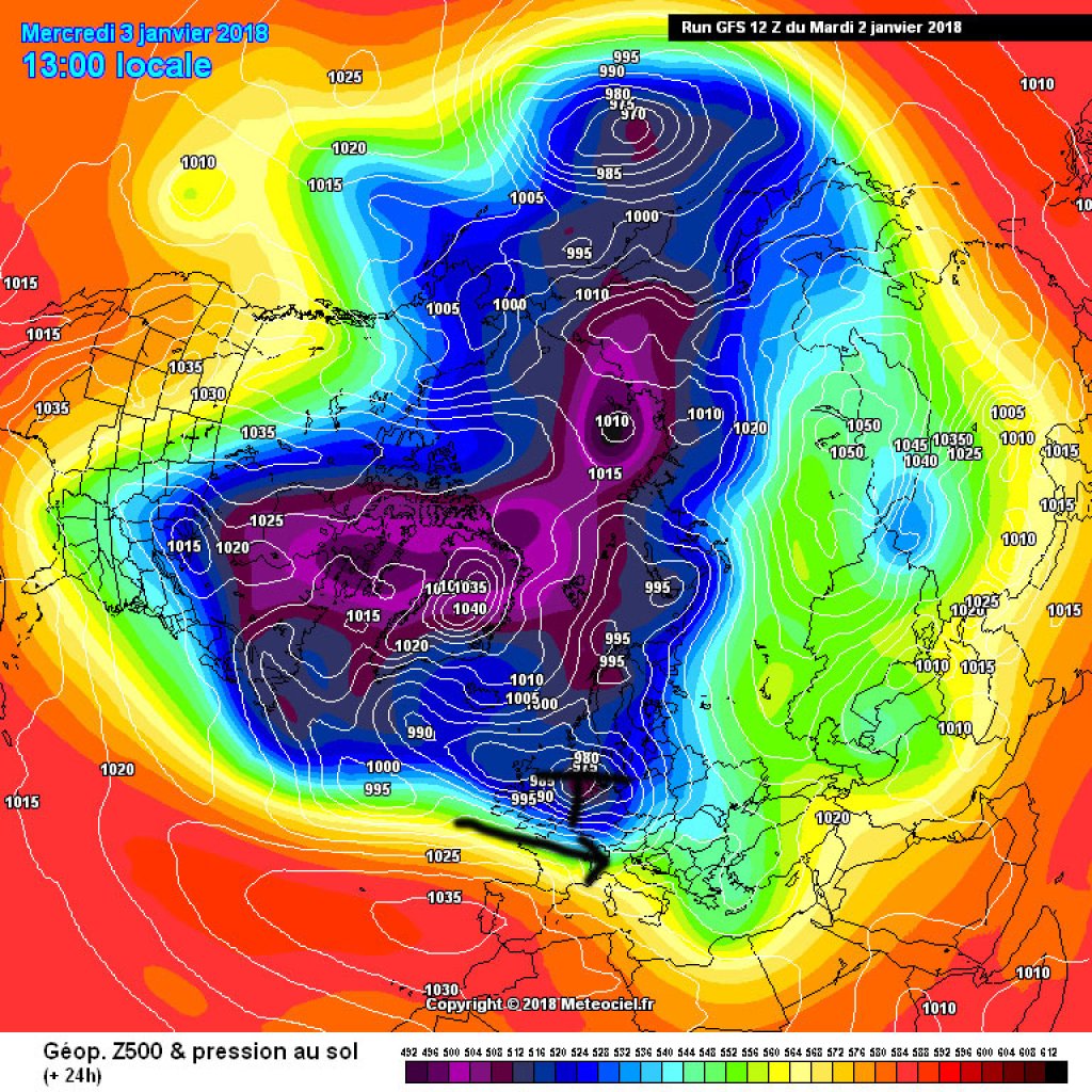
As already discussed last week, the strong westerly current is responsible for this, sending one Atlantic low after another towards us, sometimes with a stronger northerly component, sometimes more from the southwest. Depending on the weather, it will be colder or warmer. All in all, the westerly weather is good for snow accumulation at higher altitudes, but alternates between slushy weather and spring fever in the valleys.

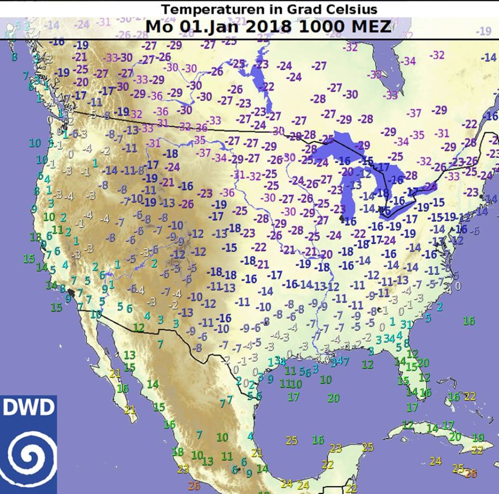
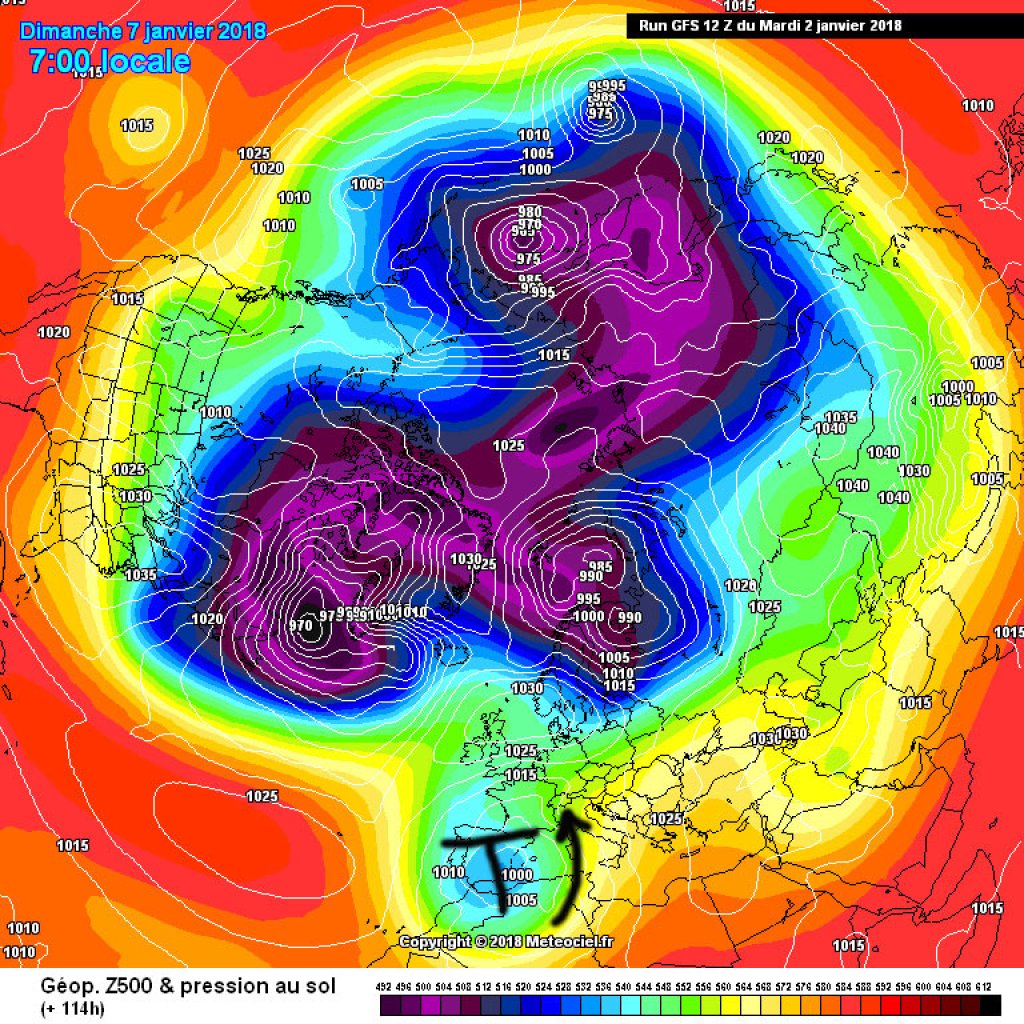
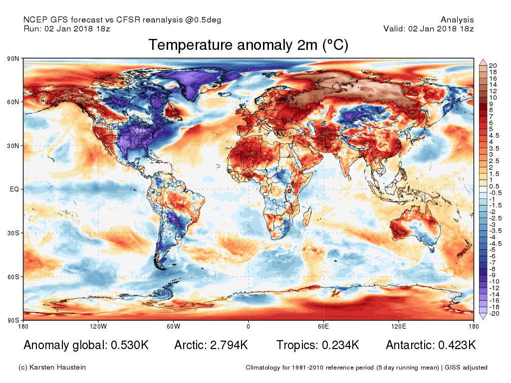
While it tends to be fairly mild on the European continent, the eastern half of North America is shivering in Arctic air, with temperatures well below -20°C in many areas, and has been doing so for a while now. As long as the cold air remains there, the low pressure activity in the Atlantic is favored, which results in our changeable westerly weather. Some model runs see a fairly strong Scandinavian high in next week's forecast. This would break up the very zonal pattern somewhat and prevent the westerly drift from rushing in unchecked

WeatherBlogs
presented by

Make Lake Effect Great Again

The Arctic air masses, which have been causing very low temperatures in the USA and Canada since Christmas, also flowed over the Great Lakes, the large lakes in the border region between the USA and Canada, last week and produced a very considerable lake effect snowfall. In Erie, a small town in Pennsylvania, 86cm of snow fell on Christmas Day. Within two days, it became 1.5m with snowfall rates of 3-5cm per hour - a new record. On New Year's Eve there was another 30cm.

Erie is located east of Lake Erie, one of the 5 Great Lakes, and a stationary lake-effect cloud band spectacularly dumped the moisture that had accumulated on its way across Erie and the other lakes. The police asked the residents of Erie to stay in their homes and to dig out the hydrants if they could no longer be seen. If the hydrants are snowed in, the fire department has a hard time in an emergency.

Lake Effect snow and cloud bands on Christmas Day.

Lake Effect snow and bands of cloud on Christmas Day.

NOAA (Suomi VIIRS True Color)

Lake effect snow forms when cold (in this case very cold) air flows over relatively warm water. Due to the temperature difference, water evaporates into the colder air and warms it. The air rises (as it is now warmer than the air above) and the absorbed moisture condenses at altitude to form clouds. The clouds usually arrange themselves in stripes, the exact orientation of which depends on the wind direction and the geometry of the body of water. When the moist air reaches the shore, the moisture precipitates as snow. As a rule, it only snows a little over the water, if at all, as the necessary friction is lacking. As soon as the lakes freeze over, the lake effect is switched off, as the "warm" water is then missing.

Lake effect snow also occurs now and again on Lake Constance in a much less pronounced form. Japan owes its abundance of snow to the "ocean effect", which works on the same principle and is intensified there by the topography. On the Great Lakes, the snowy cloud bands can sometimes move from one lake to the next (although the sequence does not match the one sung about in "Wreck of the Edmund Fitzgerald" for storms and shipwrecks *) and then dump all the accumulated snow at once, as in this case in Erie.

* Lake Huron rolls, superior sings In the rooms of her ice-water mansion Old Michigan steams like a young man's dreams The islands and bays are for sportsmen And farther below Lake Ontario Takes in what Lake Erie can send her And the iron boats go as the mariners all know With the gales of November remembered

Photo gallery

This article has been automatically translated by DeepL with subsequent editing. If you notice any spelling or grammatical errors or if the translation has lost its meaning, please write an e-mail to the editors.

Show original (German)

Related articles

Comments

WeatherBlogs
presented by