Skip to content

Cookies 🍪

This site uses cookies that need consent.

Learn more

Zur Powderguide-Startseite Zur Powderguide-Startseite

Language selection

Search PowderGuide

PowderAlerts

PowderAlert 18 2017/18 | Reset in the border triangle

After the break, another proper dump in the south-east

by Lars Oelmann 02/01/2018
There is finally cold powder again, unfortunately there is only an alert in the south-east, while in the north only small amounts fall just below the alert. The westernmost tips of France and Switzerland could be an exception.

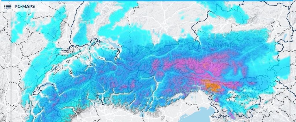
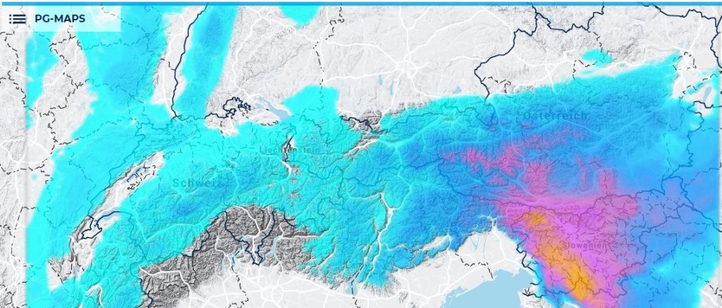
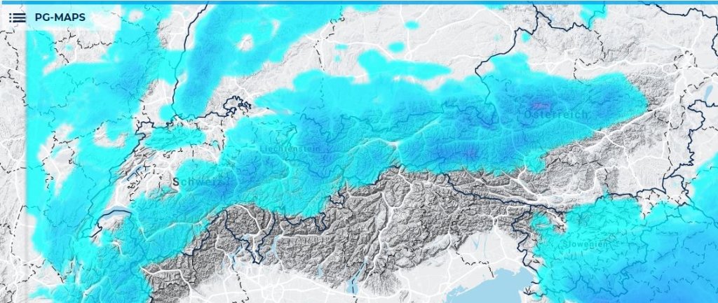
Alert areas and period:

The core is quite small and only extends from the border region in eastern Italy via Carinthia to Slovenia. In the northwest, there may still be over 30cm in the Chablais or Aravis, i.e. the westernmost foothills of the Alps. The period lasts until midday on Saturday, when it should stop snowing in the core.

Wind:

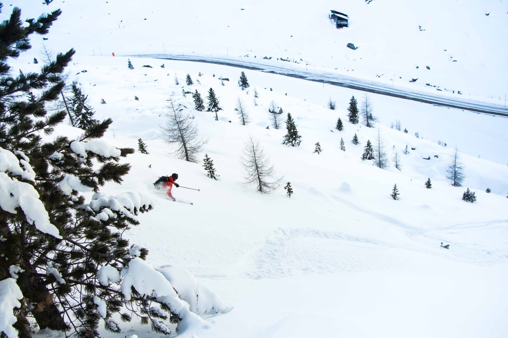
The wind is initially strong at altitude, then gradually weakens during the dump and should also leave some powder above the tree line in the accumulation areas in wind-protected locations. It also becomes particularly dangerous as the decreasing wind and calmer snow may cover old drifts.

Snow line:

Ullr has taken note of the recent alerts and is bringing cold powder snow. The snow line will initially be around 1000-1200m but will then drop quite quickly and it will remain cold, so there will be good powder there.

The amounts

In the core in the southeast, 50-90cm are pretty certain, possibly up to 120cm in a congested area in the Julian Alps. In the peripheral regions of the core, there will also be alerts, e.g. in Carinthia in the Tauern, etc. It is difficult to say how quickly this will decrease, but it should also be enough in the parts of Carinthia that are not on the border.

In the western northwest, 25-40cm can come, but otherwise it will probably remain just under an alert on the northern slopes of the Alps. Nevertheless, you should have more fun in the north than before.

Where should I go?

Into the trees in the south-east until Saturday, then on Sunday or in the ski area on Saturday afternoon above the tree line. It dries out pretty quickly when the wind shifts to the north. Then it will stay cold, so that you can slowly venture out on more interesting tours over the course of the week without the snow disappearing.

Mid-term

What exactly Ullr has planned after the weekend is completely unclear. The orca's crystal ball is very hazy. It's pretty certain to stay cold. There is no real prospect of fresh snow, but the models are very divided as to whether there should be a cold dumping layer with clouds, a more westerly setup or even a new Mediterranean low. The temperatures are right, now Ullr would just have to divert some moisture from its disaster alerts for things to go perfectly.

Powder to the people!

Your oracle

Photo gallery

This article has been automatically translated by DeepL with subsequent editing. If you notice any spelling or grammatical errors or if the translation has lost its meaning, please write an e-mail to the editors.

Show original (German)

Related articles

Comments