Skip to content

Cookies 🍪

This site uses cookies that need consent.

Learn more

Zur Powderguide-Startseite Zur Powderguide-Startseite

Language selection

Search PowderGuide

PowderAlerts

PowderAlert 2 2017/18 | To ski or not to ski?

Powder replenishment!

by Lars Oelmann 11/11/2017
As always, PowderAlert is about the existential things in life. To be or not to be; to ski or to stay at home. Decisions of Shakespearean proportions are on the agenda.

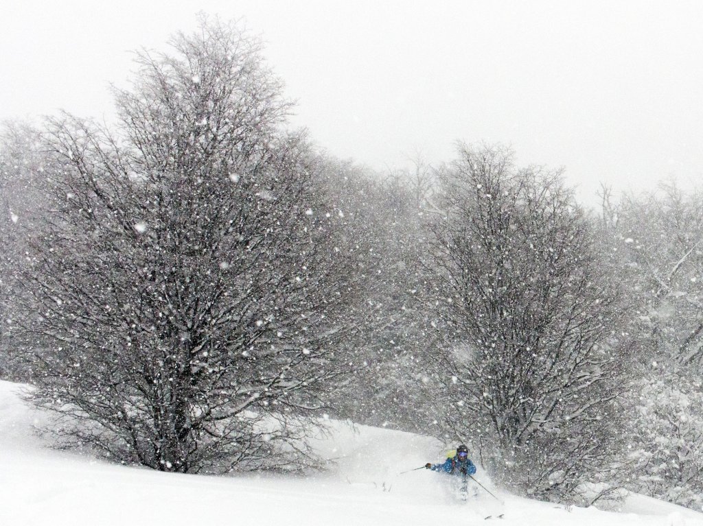
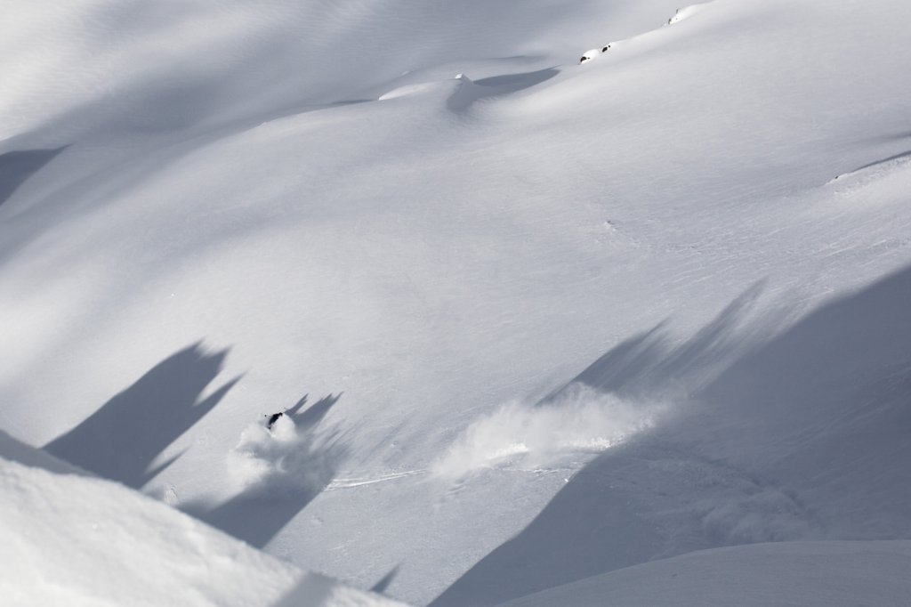
In contrast to Alarm I, there is already a base and it is also still snowing quite a lot quite far down, so you can probably get out. If, and here comes the dramatic twist, you're not tied to fixed working hours, because it's probably not worth it before Monday or even better Tuesday.

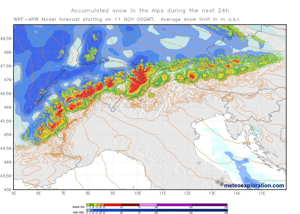
Ullr is much busier this year in the early season and the northern hemispheric setup has allowed for significantly more snowfall so far. So you've apparently been busy at the Ullr shrines, sending your modern-day prayers to our god of winter in the form of #prayforsnow. This weekend, a relatively potent trough is rushing in from the north and bringing us some real northern snow.

Alert period

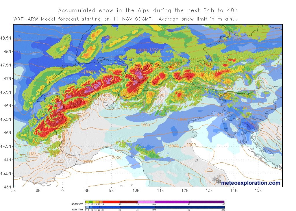
By Tuesday morning, all the powder will be on the ground.

Areas

The entire northern slope of the Alps from northern France to the Rax, with the core likely to be from the northern Valais to the Arlberg.

Snow line

It is still between 1600 and 2000m today, but will plummet with the cold front on Sunday, so that a lot will fall in the cold air in the northern congestion areas. The areas in which the models are simulating generous precipitation with the front will have problems. In general, with the current westerly flow, less will fall than in the model with cold temperatures.

Wind

We also have to make concessions here. It's not as bad as Shakespeare - we won't go mad or die a gruesome death - but there will be a heavy storm, which tends to make for long faces with fresh snow. Even after the worst of it is through on Sunday, the northerlies will be quite tight on Monday, so everything will be blown over the top. The good thing about this is that it will push everything up to the main ridge (or even beyond, e.g. into northern Ticino) and shouldn't fall much less there than in the accumulation. So if it breaks up on Tuesday, it will be extremely dangerous. The SLF is already predicting level 4 for Sunday. I think that will probably be the case almost everywhere.

The volumes

The holy grail of the alarm. How much comes out of Ullr's cornucopia? Well first of all, you should know that all models usually notoriously overestimate the front on Sunday. This means that it's unlikely to reach 50-70cm on Sunday evening, but rather 30-50cm. I could imagine exceptions in the lower Valais, as they are a bit congested in the west, but that's not certain. In general, however, the subsequent north jam is underestimated and could therefore be better than expected. Complex situation.

So, overall fall: From northern France to northern Valais 40-70cm of fresh snow, possibly 80cm in accumulation holes, but as the accumulation dries quite quickly from the west here, the chance of surprise is low.

In the core from northern Valais, or the Bernese Alps to the Arlberg, 60-90cm of snow will fall. In the potholes it will also be a meter, with the potential for 120cm here or there. From North Tyrol to the Dachstein it will probably be 35-60cm and in accumulation holes even 70cm, but it depends very much on whether and how the models underestimate the accumulation, as the main moisture tends to move towards Switzerland and the Arlberg and a lot is supposed to come with the front here in the east, which is usually disappointing. The uncertainty increases to the east as it snows longer there. East of the Dachstein, however, it's more likely to be 25-40cm.

Where should I go?

Sunday is only for the locals, who can ski up a slope in the forest in the afternoon or visit their favorite alpine pasture. Above that, everything is probably closed due to the hurricane anyway.

On Monday, you can also drive up to the Alm from student towns near the Alps, take a spontaneous vacation or set off from one of your millionaire chalets to watch the traffic jam. Everyone else wastes their working time on the webcams...

Tuesday you can repeat the whole thing or look further up, as it's probably clearing above the high fog. You have to or should be so careful that you can only ski straight ahead on 25° slopes anyway. But everyone has to decide for themselves.

Medium-term outlook

It will remain quite cool, so you can plan a tour from Wednesday and still harvest powder. There may then be more snow from the northwest next weekend, but this will certainly be explained in more detail in the WeatherBlog in the middle of the week.

Conclusion: No desert weather in sight, snow is coming! A much better start to the season than the last three years.

Powder to the people!

Your oracle

This article has been automatically translated by DeepL with subsequent editing. If you notice any spelling or grammatical errors or if the translation has lost its meaning, please write an e-mail to the editors.

Show original (German)

Related articles

Comments