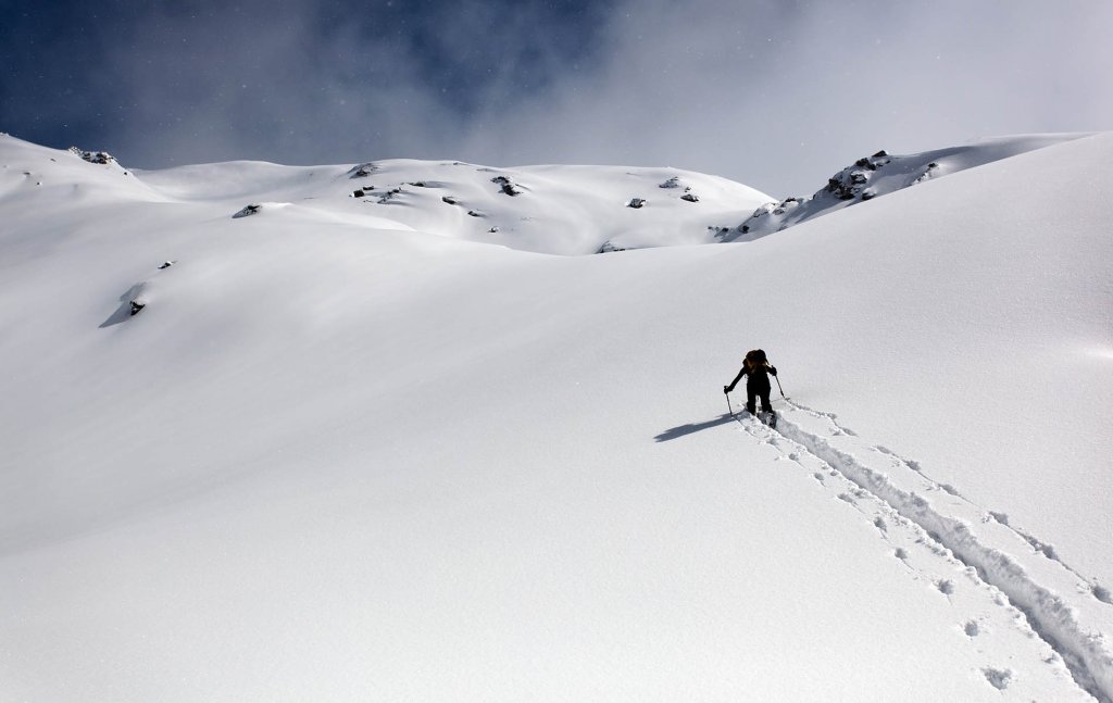
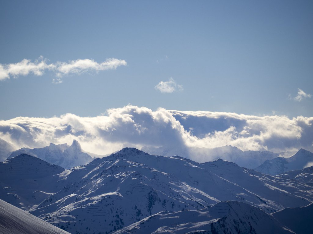
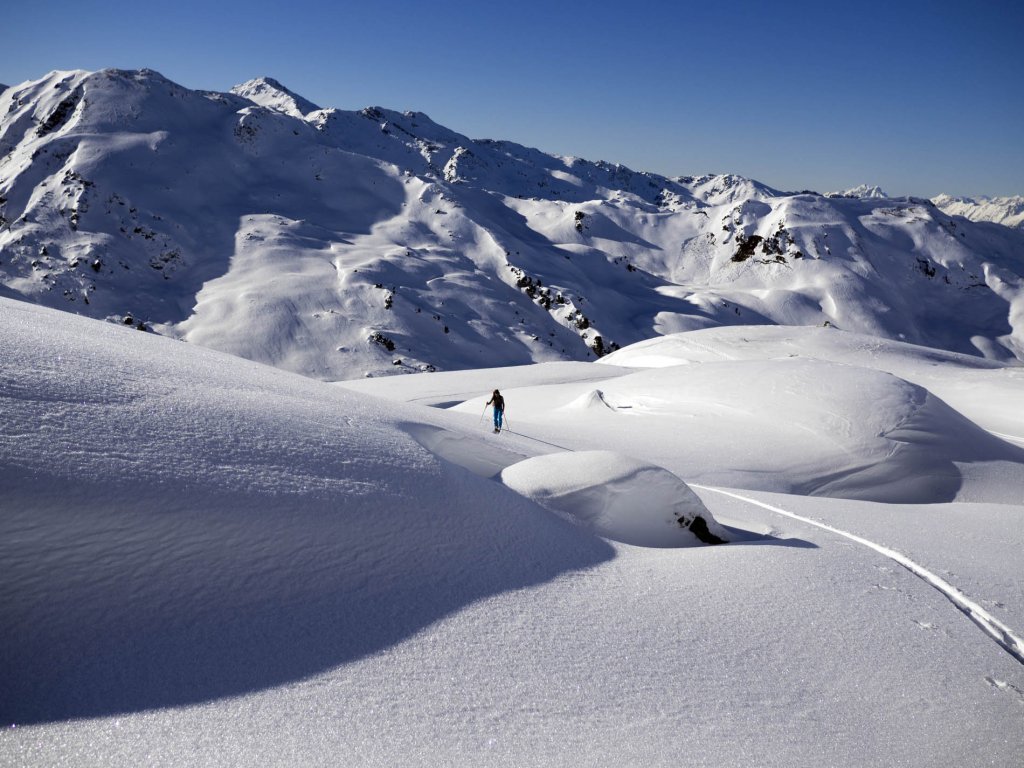
Skip to content

Cookies 🍪

This site uses cookies that need consent.

Learn more

Zur Powderguide-Startseite Zur Powderguide-Startseite

Language selection

Search PowderGuide

WeatherBlogs

WeatherBlog 10 2017/18 | Friederike replaces Borchert

Stormy times

by Lea Hartl 01/16/2018
The past weekend up to and including Monday was characterized by sunshine and high fog throughout the Alps. We count Monday as a weekend because the WeatherBlog suspects that some people took Monday "Finally the conditions are right for that steep tour I've always wanted to do". And anyway, every beginning of the week is also the beginning of the previous weekend.

Current situation

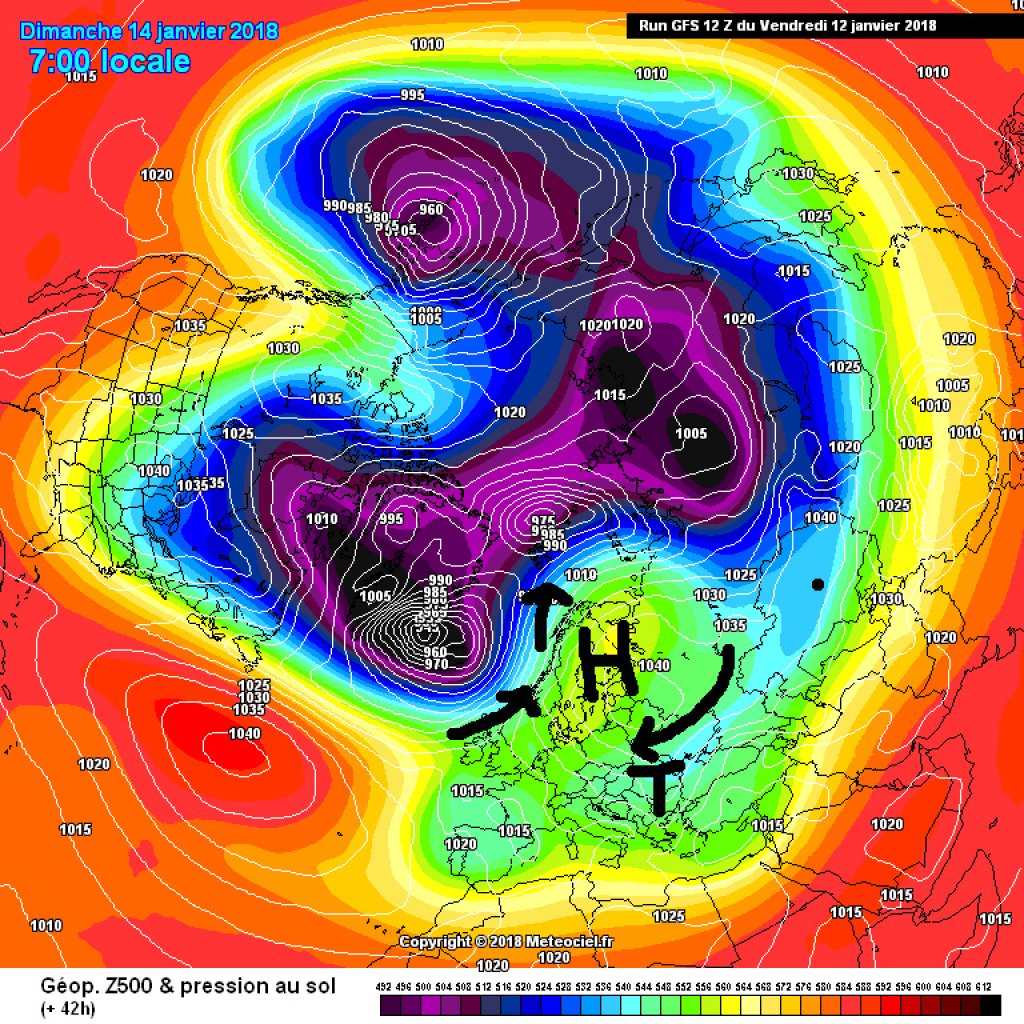
Low Borchert was responsible for the sunny days and the classic blue above, gray below situation in many valley locations. In addition to the ideal ski touring weather, the exciting north-south contrast around Borchert was also worth mentioning. Borchert was the high of a so-called high-over-low situation, in which a high settles to the north of a low. As the high is known to rotate clockwise, an easterly flow develops on the southern flank of the high, which in Borchert's case tapped into cold air from the east and transported it to the Mediterranean region. As a result, it was unusually cold in south-eastern Europe in particular. On the other hand, it was unusually warm in the far north: Borchert, in cooperation with Atlantic lows, shoveled warm air far to the north. In Svalbard, temperatures were just above zero degrees last weekend and it rained heavily.

WeatherBlogs
presented by

Borchert finally moved eastwards on Tuesday night, clearing the way for Friederike, one of those Atlantic lows. Friederike's center is located near Iceland and initially brought rain to the Alps yesterday up to relatively high altitudes. In the meantime, however, the whole thing has shifted somewhat and Friederike is no longer blowing so much from the west, but rather from a northerly direction, so that the snow line is nice and low.

The avalanche situation is extremely tense due to the considerable amounts of fresh snow in combination with the wind and surface frost produced by Borchert, which has now been covered with snow. A detailed, descriptive explanation of the problem of the snow-covered frost can be found on the blog of the Tyrolean Avalanche Warning Service.

Outlook

The jet stream is positioned directly above us and will remain there for the next few days, which will continue to bring us stormy weather. Tomorrow, a warm front will reach the Alps and it will briefly get a little warmer. The precipitation will continue, especially in the northern stagnant areas, and the oracle will have more to say about this. It will not only be wet, but also windier than today, with corresponding, mostly orange weather warnings across the entire Alpine region and parts of the German lowlands, which is more directly due to the path of the low pressure system, which will probably just miss hurricane status. The next cold front will follow on Friday with renewed cooling and snowfall.

Medium-term

The development over the weekend and beyond is uncertain. It is conceivable that one of our low pressure systems could slide into the Mediterranean, which would bring precipitation to the southern slopes of the Alps if this were to happen as predicted by some model runs. Such a situation would also be potentially interesting for the eastern edge of the Alps. It will be interesting to see!

Photo gallery

This article has been automatically translated by DeepL with subsequent editing. If you notice any spelling or grammatical errors or if the translation has lost its meaning, please write an e-mail to the editors.

Show original (German)

Related articles

Comments

WeatherBlogs
presented by