Skip to content

Cookies 🍪

This site uses cookies that need consent.

Learn more

Zur Powderguide-Startseite Zur Powderguide-Startseite
WeatherBlogs

WeatherBlog 14/2015 | Sun and stuff ...

What is the radiation balance?

by Lea Hartl 02/18/2015
The current weather is a good opportunity to take a closer look at the sun and its radiation. As we know, it is not only responsible for sunburn and the general living conditions on our planet, but also does one or two things to the snow.

Things radiate in a certain wavelength range depending on their temperature. Over 90% of solar radiation has wavelengths between 0.2 and 4 micrometres, also known as short-wave radiation. The greatest intensities are achieved in the visible range (~0.38 - 0.78 micrometers). The earth, clouds and other components of the atmosphere, on the other hand, emit long-wave radiation due to their lower temperature, i.e. with wavelengths of around 4 to 100 micrometres.

The radiation balance of the earth's surface is made up of incoming and outgoing short-wave and long-wave radiation. Solar radiation is further divided into diffuse and direct radiation, with diffuse radiation only reaching the Earth's surface after reflection or scattering (e.g. from clouds). The albedo indicates what proportion of the incoming radiation is reflected by the surface. It is primarily dependent on the type of surface and the wavelength. Fresh snow reflects short-wave radiation almost completely, while long-wave radiation is largely absorbed.

Over the course of the year, the amount of incoming radiation changes with the position of the sun: if the sun is low, the radiation hits at a very oblique angle and is distributed over a larger area, so that smaller amounts arrive per unit area. In the Tyrolean avalanche situation report this winter, it was pointed out for a while that flat south-facing slopes are sometimes easier to trigger than steep ones, as the latter receive more sunlight in high winter due to the more direct angle of incidence when the sun is low and the slope is steep.

WeatherBlogs
presented by

The influence of snow cover on the radiation balance is clearly shown in the following figure (exemplary data from a weather station in the Ötztal, approx. 2600 m altitude). The figure shows the short-wave radiation balance over a year, i.e. incoming and reflected/outgoing solar radiation. Until around the beginning of April, the curves for outgoing and incoming radiation are close together, i.e. snow reflects the solar radiation. As the snow begins to melt, less and less is reflected and the blue curve drops. The rapid increase in incoming radiation in the first few months of the year is also clearly visible. When skiing, we can feel this in the snow, which remains powdery for days at the beginning of January and quickly becomes soggy by mid-February.

While the overall radiation balance in winter (with snow) is determined by the long-wave components, the short-wave (solar) radiation becomes much more important in summer. If the total radiation balance is negative (more radiation is emitted than arrives), the surface and the air near the ground cools down more and more. If it is positive, the temperature rises.

The Earth's atmosphere is largely permeable to solar radiation, which means that the radiation is not absorbed by the components of the atmosphere but can penetrate to the surface relatively unhindered. However, long-wave radiation is absorbed and partly reflected back to the surface. The whole thing is called the greenhouse effect and ensures that we have a pleasant temperature on earth. If it didn't exist, we would have temperatures of around -18°C on the earth's surface instead of the actual average temperature of around 14°C. As the most important greenhouse gas in our atmosphere, water vapor is responsible for the majority of the natural greenhouse effect. The man-made climate change greenhouse effect also exists, but it should not be confused with the natural variant that is essential for life.

The weather outlook

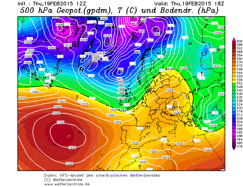
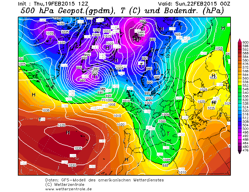
On Friday, the high pressure influence will largely remain, although the southerly wind is likely to freshen up in the foehn lines and a few high clouds will cloud the imperial weather. At the weekend, with a strong southerly current, it looks like there will be a clear Föhn wind in the north and heavy precipitation in the south. Colleague Orakel will definitely be in touch. The precipitation is also likely to spread to the north, but only in "nasty weather" quantities. Next week there will be more potential for the north again, let's see what happens.

Photo gallery

This article has been automatically translated by DeepL with subsequent editing. If you notice any spelling or grammatical errors or if the translation has lost its meaning, please write an e-mail to the editors.

Show original (German)

Related articles

Comments

WeatherBlogs
presented by