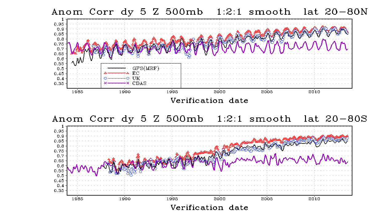
PG-Conditions reporter KarlNickel asks: "I assume (the forecasting uncertainty) is mainly due to the large amount of data and parameters that are difficult to calculate? I would be interested to know ... whether it will be possible to make reliable 7-day forecasts in about 10 years' time." Modern weather forecasting is limited in its oracle capacities by various factors:
The data basis
A weather model needs an initial state from which it calculates into the future. If it doesn't know what the weather is like today, it can't say anything about tomorrow's weather. The ECMWF (European Center for Medium Range Weather Forecasts) processes around 8 million observation data points every day. This information comes from ground weather stations, ships, buoys, airplanes and satellites, among others, and comes from all over the world. There are often errors in the data, measurements are somehow different everywhere and naturally there is more data from urban areas than from the Sahara or the North Pole. So we first have to invest some work in quality control and spatial and temporal interpolation before we can present our model with a reasonably usable initial state.
Computing capacities
So now we have a huge pile of data to which we want to apply various, not entirely uncomplex calculations. Oh yes, and then we also have to take the topography into account, because we need the Arlberg in the model to see whether there is northern congestion there. We can calculate all of this now, but even the most powerful supercomputers are simply too slow to always calculate at the best possible resolution and to finish in a timely manner. So we have to decide whether we want small-scale, high-resolution predictions for a short period of time or coarser predictions for a longer period of time. Some people claim that it would be possible to produce an almost perfect 24-hour forecast today, but the calculation would take two days, which would be useless.
The chaos
The Earth's atmosphere is a chaotic system. This does not mean that there are no rules at all, but it does place certain theoretical and practical limits on numerical prediction. Deterministic chaos means that the system
reacts very sensitively to the smallest changes in the initial conditions
and corresponding errors grow exponentially.
The system is not periodic, meaning that a certain state never repeats itself exactly.
Local instability with global stability. Small-scale changes in the system are not predictable, but large-scale changes are.
The behavior of the system is not random, but chaotic in this sense. You can imagine the whole thing like a ski bag, in which you not only pack your skis and poles, but also all the important small items, from blister plasters to screwdrivers. Before we finally close the bag, we know exactly where everything is. Then we check it in with the bulky baggage and don't see it again until a long-haul flight later. Depending on how much space was left in the bag, how gentle the baggage people were and how turbulent the flight was, the position of the screwdriver may have changed completely and we only know that it is (hopefully) still somewhere in the bag. However, the skis remain more or less in the same place due to the constraints (= dimensions of the bag) and it won't have suddenly turned into a bike either.
So...
Yes, it is possible that we will have a good 7-day forecast in 10 years' time. For that we need faster computers and better initial conditions (observational data). There will still be better and worse forecasts, depending on the weather conditions (if we travel first class by train from Innsbruck to St Anton, the screwdriver in the ski bag will tend to move less than if we fly from Buxtehude to Srinagar and change trains five times), and the forecasts will probably never be completely perfect.
Finally on the current situation:
PG reader No Friends on Powder Days asks: Is there still hope despite the "ominous Omega/polar vortex split thing"? Well, the Omega thing is like a completely stuffed ski bag on a quiet train ride - pretty sure pretty little will move. Towards the end of the medium term, the models keep showing variations that could change the weather situation, from a slow eastward slide of the low in the Atlantic and the resulting south-westerly position to a weakening of the Omega high and a weakening of the blockade. However, as I said, this is more in the realm of crystal balls. For now, you should definitely prepare for sunshine in the mountains and high fog in the lowlands.


