Skip to content

Cookies 🍪

This site uses cookies that need consent.

Learn more

Zur Powderguide-Startseite Zur Powderguide-Startseite
WeatherBlogs

WeatherBlog 8/2015 Northern congestion - what exactly does that mean?

Reader question from Benni

by Lea Hartl 01/07/2015
Accumulated precipitation, also known as orographic precipitation or precipitation on a slope, occurs when air masses hit an obstacle and are lifted by it. The air becomes colder the higher it rises and when it reaches a certain level, the water vapor it contains condenses. Small droplets or ice crystals form, which precipitate as soon as they have reached the required size.

PG reader Benni asks:

It's clear that a lot of snow comes down in areas like Damüls, Lech/Arlberg, Seegrube and Fieberbrunn when there's a northerly dusting, but what exactly does that mean in meteorological terms?
Do the air masses snow down exactly when they hit the northern foothills of the Alps, or are they first lifted (adiabatically) in order to snow down at a higher altitude?
Why does a regionally limited area such as Körbersee (Schröcken) always get a little more snow than the surrounding area anyway when there is a northerly accumulation?
What about lee effects? It is well known that the Axamer Lizum, located in the lee of Innsbruck's Nordkette mountain range, gets less snow in north jams. But what about Fieberbrunn, for example, which is a snow hole despite not being too high up? Does it get the full blast with N or NW winds, and only the economy pack with more westerly winds, i.e. in the lee behind the Wilder Kaiser massif?

How strong the accumulation effects are, why they are sometimes more productive here and sometimes there and other decisive details of this kind depend on various factors.

On the one hand, there is the topography. Imagine the inflowing air masses like a stream in a stony streambed. If there is a single large stone, the water flows around it rather than over it. It's easier because of gravity and all that. But if the WeatherBlog comes along and builds a dam (we loved doing that when we were kids!) and the water can't get past it, then it builds up and rises until it flows over it. Or rather, it builds up for a short while and then some stupid stone doesn't hold anymore and we have water in our wellies and cold feet, but perhaps we shouldn't digress too much. In any case, a long mountain range (such as the Northern Alps), around which the air cannot get around, has more accumulated precipitation than, say, a single volcano, which can also be flowed around. Smaller-scale terrain also plays a role. For example, if you imagine a mountain massif in the shape of the letter U (viewed from above), then it is logical in terms of the rocky stream that the accumulation is stronger if the flow comes from the direction of the large PowderGuide banner at the top of the page and not from below.

WeatherBlogs
presented by

The reservoir areas mentioned by Benni are known as such because they are conveniently located on the north side of the Alps. Fieberbrunn may not be very high, but it is located in the first higher mountains after the lowlands. You should also bear in mind that there are no ski resorts in other possible congestion spots in the area, but of course just as much snow can fall there (e.g. in the cirques of the Loferer Steinberge). Special effects such as that of the apparently snowy Körbersee can often be explained by small topographical features, but in this case the WeatherBlog does not know whether this is actually a measurable local peculiarity. Other factors, such as less susceptibility to wind, can also cause a significant increase in fresh snowfall.

On the other hand, it also depends on the strength of the current and the stratification of the atmosphere. In typical northerly dust conditions, the wind is rather weak at altitude, but quite strong near the ground. If the wind is strong above ridge level, the air masses lifted from the lower layers, which are needed for the desired dump, are sometimes simply blown downwind together with precipitation over the peaks. Although the Axamer Lizum is located in the lee of the Nordkette during a northern thaw, the Nordkette itself is located in the lee of the Karwendel.

Where exactly it snows the most depends on how long it takes for the snow crystals to become heavy enough to fall and how long the mountains are flooded. If the time it takes to grow and fall is longer than the time it takes for the air parcel in question to rise up the mountain and be blown over it, then the precipitation will only fall on the lee side of the mountain. The growth time of the crystals is shortened if precipitation is already present before it reaches the mountain, for example during approaching showers or frontal precipitation. As there are already large ice particles in the cloud beforehand, the snowflakes are quickly large enough to fall out when the mountain is reached and the air is lifted. It can also have a strong effect if there are other clouds above the lower cloud layer that seed precipitation particles into the lower clouds, which then grow rapidly there (seeder-feeder effect). This effect is sometimes very strong with frontal precipitation, which is intensified by the orography (= front meets mountains), so that the amount of precipitation at higher altitudes can be many times higher than in the directly neighboring lowlands.

For an effective northern accumulation, it is best to have a strong northerly flow near the ground, but rather weak wind conditions above ridge level, in combination with light snowing/snowing clouds higher up. What exactly this combination looks like will then determine whether it snows more on the Seegrube in a given northerly flow or on the windward side of the Dammkar.

The weather outlook

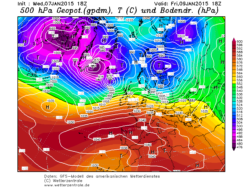
Thanks to a very strong westerly flow, the weather will be changeable and windy over the next few days. On Friday, it will be extremely windy and mixed with some precipitation in places, but also windy but sunnier in the south. Saturday looks very warm and stormy at the moment, Sunday will be colder again with snow in some valleys. We'll leave the colleague Orakel to predict the amounts, if it's enough, which is rather dubious at the moment.

Photo gallery

This article has been automatically translated by DeepL with subsequent editing. If you notice any spelling or grammatical errors or if the translation has lost its meaning, please write an e-mail to the editors.

Show original (German)

Related articles

Comments

WeatherBlogs
presented by