Skip to content

Cookies 🍪

This site uses cookies that need consent.

Learn more

Zur Powderguide-Startseite Zur Powderguide-Startseite
WeatherBlogs

WeatherBlog 9/2015 Review and outlook

Review of the past weekend

by Lea Hartl • 01/14/2015
While our colleague Orakel oracles and discusses the exciting future, this week's WeatherBlog deals with the boring past, which has recently been characterized by hurricanes, rain and cancelled freeride and Alpine World Cup events.

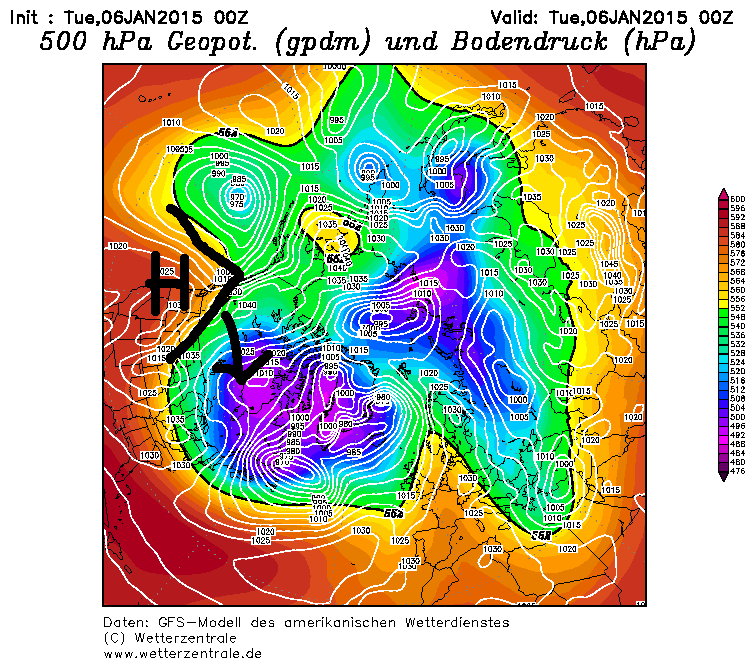
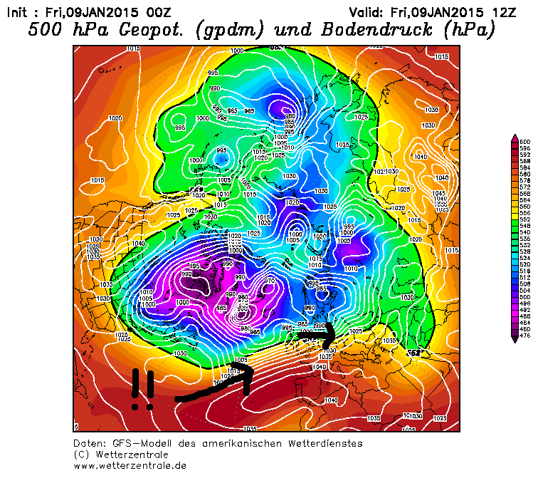
The WeatherBlog was asked why it was so warm last weekend, even though the weather was somehow coming from the north. We'll start with the related question of why it was so windy and generally uncomfortable in the first place. The long-standing purple blob of cold air over Canada was shifted a little to the east by a high reaching far to the north in the west of the North American continent (nice weather in AK?).

From here, the blob can virtually run out into the Atlantic and very cold air in combination with rather warm water can have a stimulating effect on the development of low pressure. In combination with the strongly pronounced Azores High and Icelandic Low, this resulted in Elon and Felix, two storm lows that effectively worked together to give us a meteorologically interesting weekend.

The current had a small north föhn component due to the poor corrugation over Central Europe, which caused north föhn and also some accumulated precipitation (first rain, then a little snow). Although this was somehow a northerly flow, the air masses were originally not really from the north, but rather from subtropical regions and correspondingly warm. If you then add in the effects of the foehn, it's surprisingly easy to reach over 20°C in January.

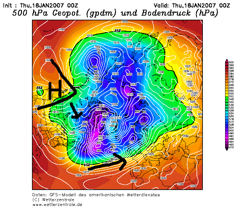
Note the similarities to Hurricane Kyrill, which incidentally reached similarly high temperatures.

WeatherBlogs
presented by

The weather outlook

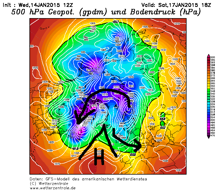
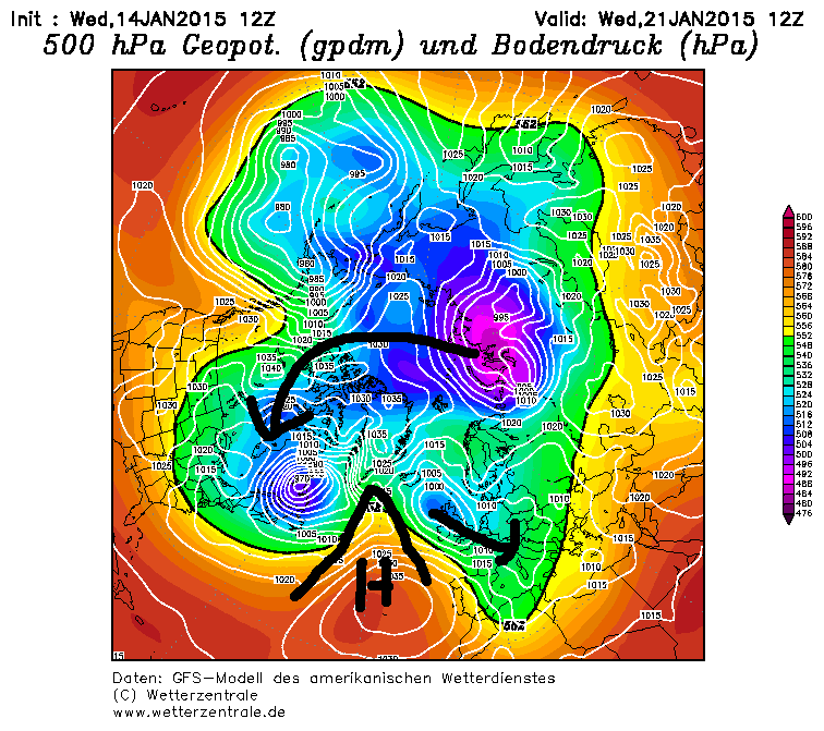
We will leave the details to the oracle, who has already announced himself. Due to a wedging of the Azores High, a trough may develop downstream (east), reaching as far as the Mediterranean and bringing precipitation to the south (oracle). As the wedge does not extend far enough north to disrupt the westerly drift (polar vortex split), cold air can continue to flow over the pole into the Canadian Purple Blob, which creates action in the Atlantic and the wedge is swept away. Next week is currently shaping up to be a repeat of this process:

(The WeatherBlog is very proud of its painting skills, by the way.)

Photo gallery

ℹ️PowderGuide.com is nonprofit-making, so we are glad about any support. If you like to improve our DeepL translation backend, feel free to write an email to the editors with your suggestions for better understandings. Thanks a lot in advance!

Show original (German) Show original (French)

Related articles

Comments

WeatherBlogs
presented by