Skip to content

Cookies 🍪

This site uses cookies that need consent.

Learn more

Zur Powderguide-Startseite Zur Powderguide-Startseite
WeatherBlogs

WeatherBlog 9 2016/17 | Alert details

Snow in the east, then high pressure, then option for wintry conditions

by Lea Hartl 12/27/2016
Why does only the East get something from the PowderAlert? What happens afterwards? What about the possible weather change at the turn of the year?

Current situation

We are located between a high pressure system over western Europe and a low pressure complex in the east. This combination is producing a partly stormy northerly flow in the Alpine region. Our colleague Orakel has sounded the alarm for the eastern Alps. A long warm front is responsible for this, which has moved to the eastern northern side of the Alps during the night. The snow line currently seems to be hovering around 700-800m, and it is already snowing in the alert areas, mostly with strong winds. It will remain dry further west and in the south. By Thursday, the whole thing will be over in the east and high pressure will prevail across the entire Alpine region.

WeatherBlogs
presented by

Outlook

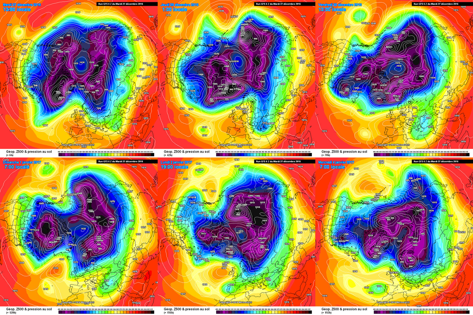
The high pressure will continue to dominate the weather throughout the Alps until New Year. Another inversion will form, it will remain frosty in the valleys and lowlands and there will be high fog here and there. At the top, it is milder and very sunny. Meanwhile, the large-scale pressure constellations in the northern hemisphere are gradually shifting a little. The polar vortex arranges itself around an implied high-pressure bridge between Greenland and Alaska and forms two larger parts, one with a core over the Asian continent and one with a core over Canada. What exactly this means for us is still unclear and changes with every model run. In contrast to the last few weeks, however, it currently looks as if this time we will at least come under the influence of the cold, damp parts of the constellation in some form, instead of being stuck in a permanent high.

Depending on how the large pressure centers arrange themselves, both a damp, mild NW situation with snow in the mountains and a clean northerly situation are conceivable. The most important factor here is whether the Azores High gives a jolt and stretches out its fingers to the north. This would produce a meridional jet, in which case the Alps would be on the right side. If the Azores High is not particularly pronounced, the flow will remain more zonal and the Atlantic influence would be more noticeable. Be that as it may, the changeover, which has been heralding itself for a while with small indications (cold Greenland, westerly breakthrough at Christmas), seems to be just around the corner.

Photo gallery

This article has been automatically translated by DeepL with subsequent editing. If you notice any spelling or grammatical errors or if the translation has lost its meaning, please write an e-mail to the editors.

Show original (German)

Related articles

Comments

WeatherBlogs
presented by