From a meteorological point of view, spring begins at the beginning of March, which we, as well as various weather services, take as an opportunity to look at a few key statistical data. Otherwise: A greeting from the desert makes the snow yellow.

Second warmest winter in recorded history
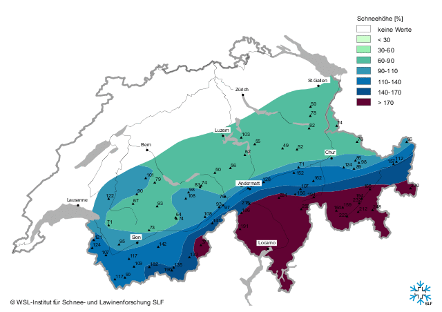
In Austria, the winter of 2013/14 was the second warmest in 247 years of recorded history. Only 2006/07 has ever been warmer. In terms of precipitation, the extreme north-south contrast was characteristic of this winter, with temperatures in the south also exceeding the long-term average. Across Austria it was 2.7°C warmer than average, in East Tyrol and Upper Carinthia it was still 2.1°C warmer despite the masses of snow. The coldest inhabited place in Austria this winter was St. Jakob im Defereggental. At -4.8°C, the average winter temperature there this year was not quite two degrees above the long-term average. Despite the very wet winter, the amount of snow in the southern lowlands is below average, as most of the precipitation fell as rain.


The many days with strong south föhn winds were also statistically unusual: on the Patscherkofel, for example, there were 29 days with wind peaks of over 100 km/h. Foehn-related closure days in the main season also annoy the ski resorts. In this article, you can read how the Stubai Valley is trying to solve the problem by building more lifts.
Sahara dust
In keeping with the generally warm winter, parts of the Southern Alps and the main ridge were covered in a layer of Sahara dust last week. In the north, the dust was more visible in the air and then trickled onto roads and cars in Munich. This is not too unusual, but still interesting according to the WeatherBlog. Mineral dust, which is whirled up by the wind and transported over long distances at high altitudes in suitable weather conditions, is the largest source of aerosols in the northern hemisphere. According to the DWD, around 1.8 billion tons (!) of desert dust are blown around every year. Around two thirds of this dust comes from the Sahara. Saharan dust is an important fertilizer for the Amazon region and the oceans, among other things. For us, it causes at most a little astonishment because it makes the sky appear milky or the snow yellow. The dust has a direct impact on the climate, as it absorbs and scatters sunlight and can change the radiation conditions accordingly. Under certain circumstances, it also influences clouds and precipitation formation.
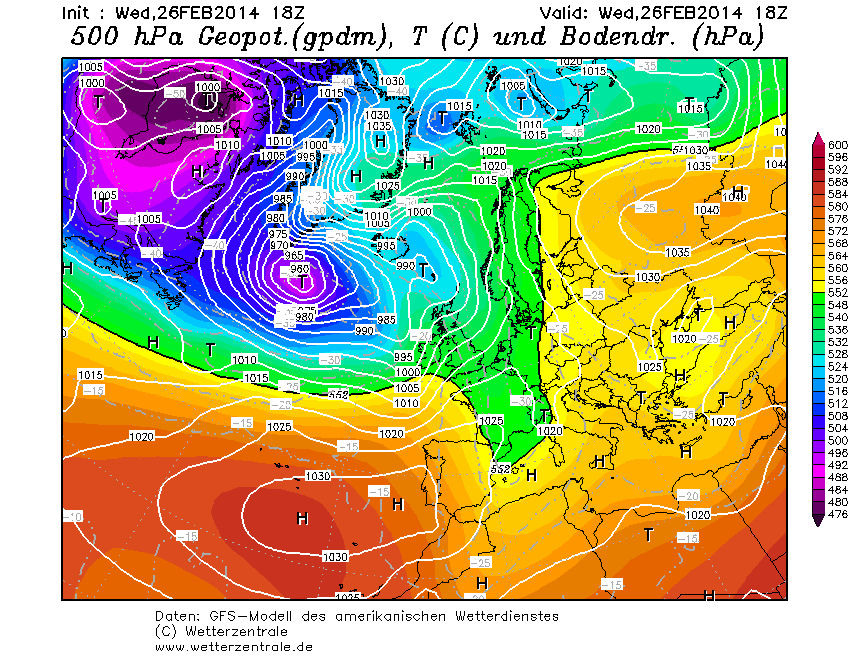
To bring the dust to us, you need a long-wave high-altitude trough that causes a large-scale southerly flow and sandstorms in the Sahara that stir up the dust and transport it upwards, from where it then heads north.
Outlook
After a few days with weak gradients and mostly great snow conditions (only where there is snow, of course), it should slowly become more unstable again from tomorrow. There will be some precipitation on Friday and at the weekend, mainly on the southern slopes of the Alps. In the north, partly sunny and partly cloudy.