Question from Tobi: A meteorologist, who is one of the more forecast-minded types, once told me that the stable weather conditions, i.e. good for a long time or bad for a long time (it's always a question of perspective, of course), have increased significantly. This is also in line with my personal perception, although you can be very wrong. Are there any empirical findings on this or what do you think about the trend?

Oh dear. Tobi has a talent for questions that sound simple but are terribly complicated, a talent already known to the WeatherBlog. The WeatherBlog has done some research and presents a study that roughly addresses the answer.
Stable weather patterns?
Of course, the first thing we ask ourselves is how to quantify "good for a long time or bad for a long time". For a few years now, various indices have been in use to identify blocking situations. One such index, let's call it B1D, according to Barnes et al. (2012), defines a longitude as blocked if the geopotential gradient of the 500hPa surface reverses for more than 5 days (meaning roughly easterly winds instead of westerly winds aloft). The latitude to be considered is determined by the maximum of the turbulent kinetic energy. In other words, the mean latitude of the "storm track" is calculated for each day of the year and checked to see if everything works.Another index, D2D according to Dunn-Sigouin et al (2013), looks for neighboring areas of geopotential anomalies with a field reversal of the absolute geopotential height on the side of the anomaly maximum closer to the equator. If these areas overlap to a certain extent from one day to the next and also persist for a certain number of days, blocking is defined.A third index, M2D according to Masato et al (2013), applies a similar tactic to B1D, but in two dimensions. It looks for a reversal of the geopotential gradient in connection with the breaking of Rossby waves.
Are there trends?
Thankfully, Barnes et al took the trouble in this study to calculate these 3 indices for the last 30 years for the northern hemisphere, based on various reanalysis products from ECMWF, NASA and NCEP. You first have to find out what this strange 500hPa area looked like at some point. Trends in the indices are calculated using the least squares method and analyzed for significance. The following figure shows the average number of blockings per month for the years 1980 to 2012 and the monthly periods December, January, February (left) and June, July, August (right) based on the NASA reanalysis data for the three indices. Here you can also see what one-dimensional means in the case of B1D and two-dimensional for the other two. The red and blue boxes show areas in which the blocking frequency changed significantly during the period 1990-2012. The position and color of the boxes changes depending on which months and years you look at. The version shown here is one of many possibilities and the authors of the study see it primarily as a sign that there is no general increase in blocking in the northern hemisphere, but that changes, if any, vary seasonally and regionally.

The next figure shows the development of the indices since 1948 on the basis of NCEP reanalyses. This shows the strong variability of the indices and that they do not coincide in all regions. It is very difficult to separate this natural fluctuation from long-term trends for any variable that is inherently volatile. In any case, the authors of the study come to the final conclusion that there is no general increase in blocking locations, but that isolated regions show robust trends (in both directions) in the indices at certain times of the year (not Europe in winter). They consider a correlation with the extent of Arctic sea ice to be possible, but explicitly point out that it is complex to clearly determine such a correlation. The study is comparatively easy to read and goes into more detail on sea ice, if anyone is interested.

As above, here we see the blocking frequency for winter (left) and summer (right), this time across Europe for the years from 1980 onwards and broken down not only by indices but also by the different reanalyses. Trends that are considered significant are marked in the legends with an asterisk on the colored line in front of the name of the reanalysis product (e.g. top right graph for MERRA and NCEP). Points (asterisks) in the curves indicate the 5 years with the maximum (minimum) extent of Arctic sea ice in the previous September.

Conclusion
The findings of Barnes et al. seem to indicate that there is no increase in long bad or long good, although the meteorologist mentioned by Tobi may have other findings. In any case, this has little or nothing to do with personal perception, which tends not to fall within the realm of the natural sciences.
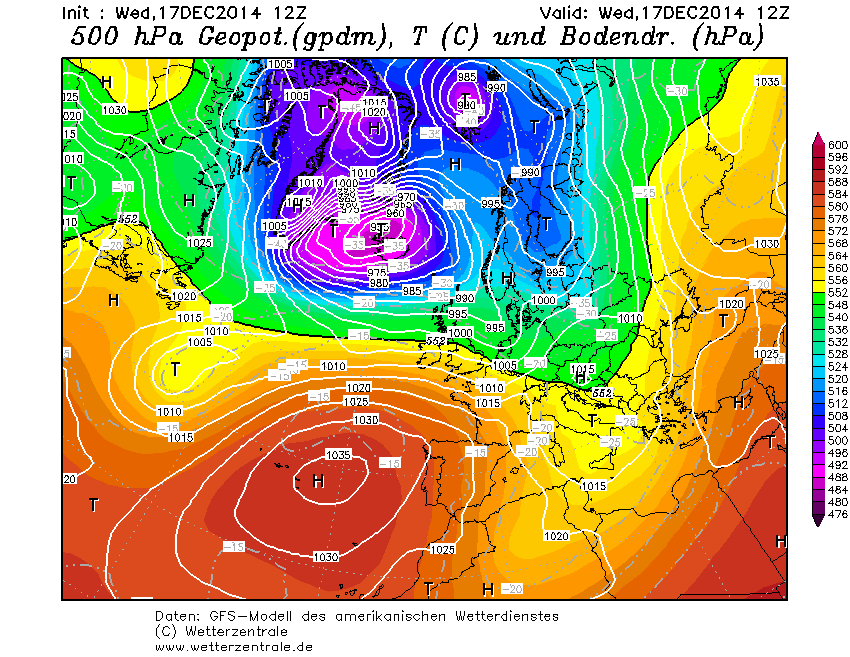
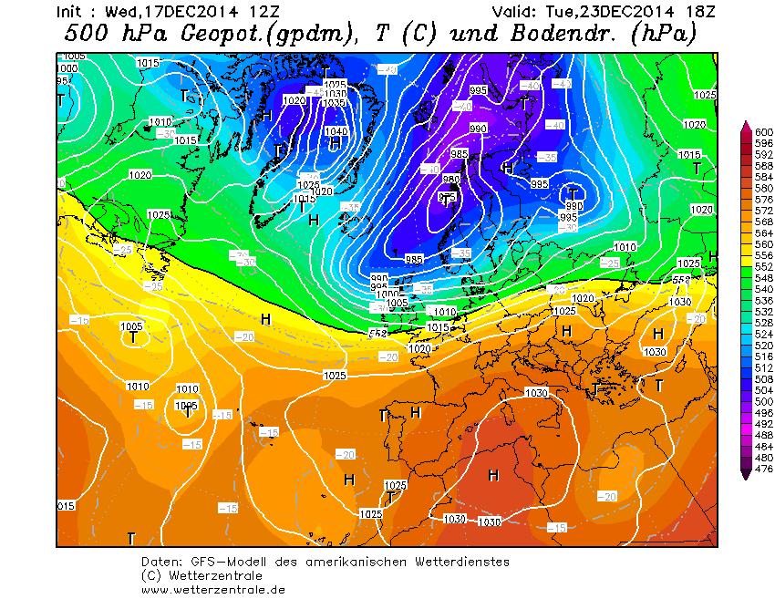
Weather outlook
The changeable and mild westerly weather is here to stay. A warm front on Thursday will be followed by a calmer, relatively sunny Friday, followed by smaller fronts and a mixed weekend. None of this will really bring much snow, and certainly not at low altitudes. A white Christmas in the lowlands would be a surprise from today's perspective. There are still options for winter as we imagine it, but they have been around for a while.