
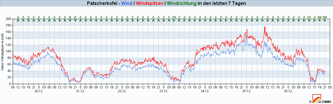
The WeatherBlog was inspired by ski instructors today and is in a foul mood, so just a brief overview: There is a low pressure system west of the British Isles and one in the Mediterranean. Thanks to our colleague Orakel, we already know what the latter is up to. In the south, the snowfall totals are record-breaking, while not much is happening in the north. What is happening is rather worrying for the general snow situation, as it is floating away below around 1500 m, if it is still there at all. The snow line in the south isn't exactly at winter level either, but at least there's now a base further up again. Friday will be quite sunny in large parts of the Alps as the Mediterranean low weakens and shifts and we come under a high pressure bridge between the lows. The powerful low pressure system off the British Isles is already approaching and we will remain in the south-westerly flow we are already familiar with. It will be foehn again and we can expect the zero degree line to rise to well over 2000 meters. It will also be windy in foehn lines, but tomorrow's event will not be able to keep up with the much more impressive foehn storm on Christmas Eve. Wind speeds were reached on the Patscherkofel, for example, that you definitely wouldn't want to be in.
After the warm, reasonably sunny day tomorrow, the aforementioned low will bring us the next front on Saturday and with it precipitation again. Once again, the west and south will benefit. As the whole thing is fed by somewhat colder air masses this time, the WeatherBlog hopes to be spared the rain. Howling ski course children are very difficult to appease with rain-soaked and therefore soggy, slimy sweets. No real changes to the general weather situation are to be expected as long as the cold air center over Canada remains in place and produces the Atlantic lows that bring us mild, humid frontal weather.


